October 21, 2005. 0930z.
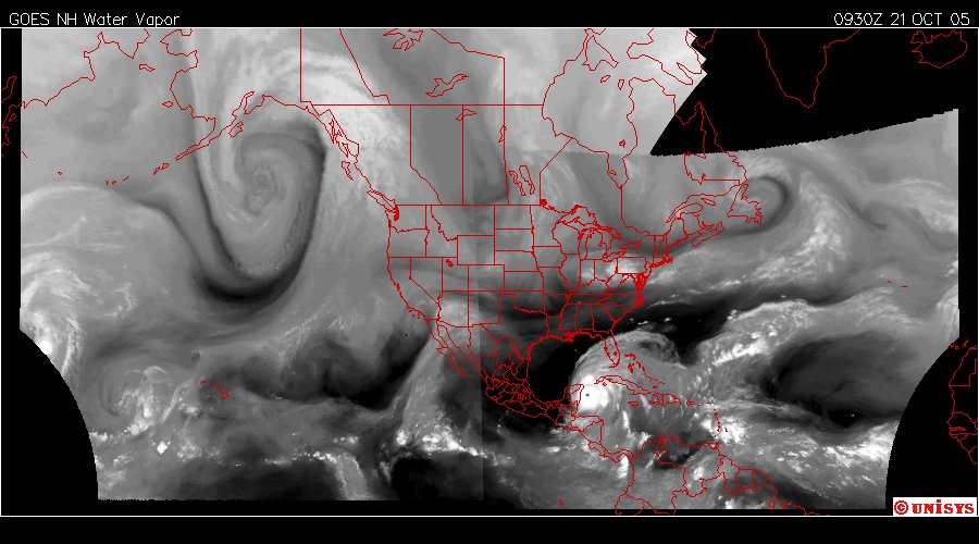
This is the western and hemispheric water vapor satellite.
The vortices are back to locations I am familiar with from 2002.
The North Atlantic which oscillates between Mid-Atlantic and Newfoundland/Laborador coasts and as far west as the Hudson Bay. At times when the vortices were at a maximum of seven circuating around the Arctic Ocean there was a vortex over the Mid-Atlantic AND the Hudson Bay.
But, back to today: The vortices location is a bit historical and noted above 40 degrees latitude.
The storm called 'Wilma' is noted at the Yucatan. The supporting vortex flow is directly east of that location splitting into an 'intake' of heat from Africa and 'output' to the Arctic Circle toward Europe. Remembering this is a globe and not a flat dynamics with forces that matches that shape.
Noted is the 'disappearing' vortex flow over NA with the high turbulence of 'Wilma.' It is bearly discernable. That is because 'Wilma' is inserting it's forces over top of it forcing that vortex flow with minimal if any vorticity to lower altitudes. It has been my experience with these systems that is normally a 'landfall' site I call 'an insertion site.' I cannot guarantee that insight but only express it as my experience. It is offered here for the chance the computers are not seeing all the dynamics in their CPUs.
I seek no authority but only my own opinion at this time. I defer to all current authorities in their directives for the safety of people along the coast of all these countries.
Good luck to all.
