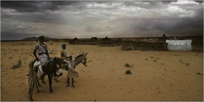
 September 10. 2006.Tawia, Sudan. These are villagers of Darfur facing not only the threat of genocide but also unfrendly drought with a potential dangerous and sudden cloud burst causing erosion. Noted in the foreground of the picture, the youngster seeking milk from it's mother burrow. Drought affects people and lifestock alike. I would imagine the burrow serves as a source of milk for the family as well as it's young. The wisest investment this family makes is to be sure the female lactating burrow is well hydrated and fed as she supplies nutrients as well as fluid to all of them.
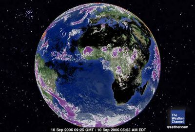 September 10, 2006. 0925 gmt. Africa - Europe Satellite.Africa has a normal equatorial aire masse. There was a Nobel Peace Prize winner that plants trees in Africa. Americans should take note, that Arbor Day which virtually goes unnoticed in the media occurs every spring.Arbor Day across the states (click on) The National Arbor Day Foundation (click on)
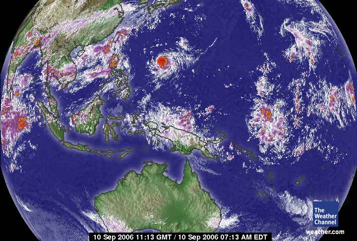
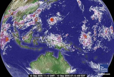 September 10, 2006. 1112 gmt. West Pacific Satellite. The Pacific disturbance that reaches to South America and Antarctica manifests over New Guinea.
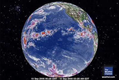 September 20, 2006.0629 gmt. Pacific Global Satellite.The displacement of the Pacific equator is north and the ionic distrubance reaching from Antarctica across South America is to the heat densities of the Mid-Pacific.
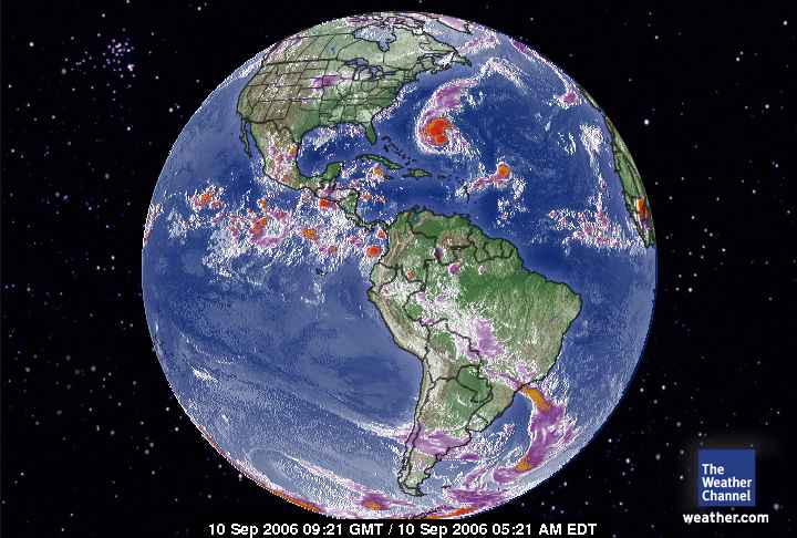
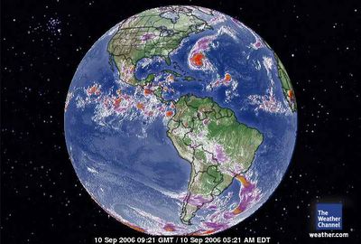 September 10, 2006. 0921 gmt. Western Hemisphere Satellite.Noted the equatorial disturbance. In order for Earth to manifest a 'cooling storm' called Florence the vapor from the equator was harnessed to increase that dynamics. Also noted is the extensive peripheral circulation of the Antarctica Vortex to the equatorial regions of the Amazon. Noted also in the southern hemisphere is a huge ionic disturbance along with the vortex equatorial reach. This disturbance includes the Mid-Pacific. The concentrated effort by the physics of Earth to build Florence has deprived the globe of the capacity to create storms elsewhere including the East and West Pacific. Why Flroence? Because of the condensed heat in the Atlantic due to the dense carbon dioxide over the USA.
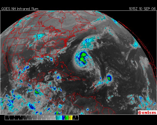
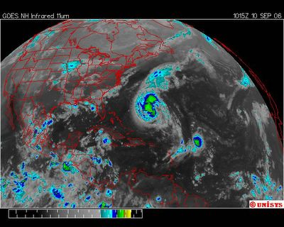 September 10, 2006. 1015z UNISYS GOES East Satellite.
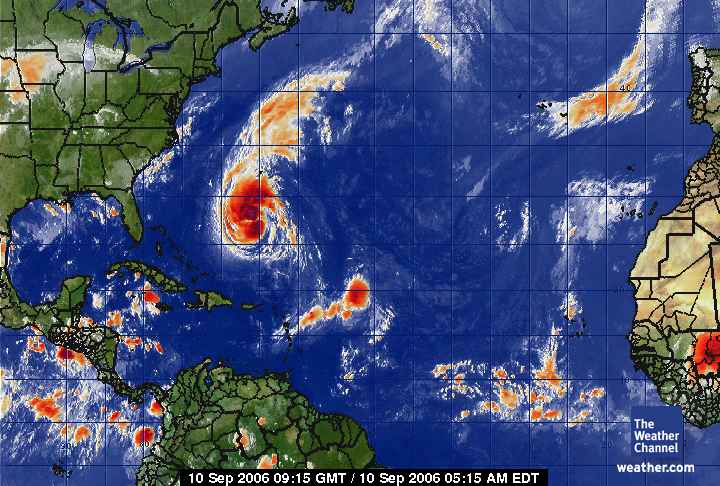
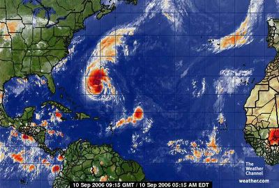 September 10, 2006. 0915 gmt. Tropical Atlantic Satellite.Noted the circulation system southeast of Florence. That might become a significant threat to potentially the Gulf and/or the East Coast. It is far lower in latitude with a different trajectory than Florence, especially if there is an East Pacific storm to oscillate the system. This smaller system could be absorbed by Florence as well as it grows in strength. I consider the entire planet a system so these storms are more of an overall equation than individual systems. In the reverse, if Florence diminishes in strength/velocity the smaller system currently without a number will manifest in greater capacity. It's the way I see it and considering the events of the recent past there is no reason not to speculate to the outcome.
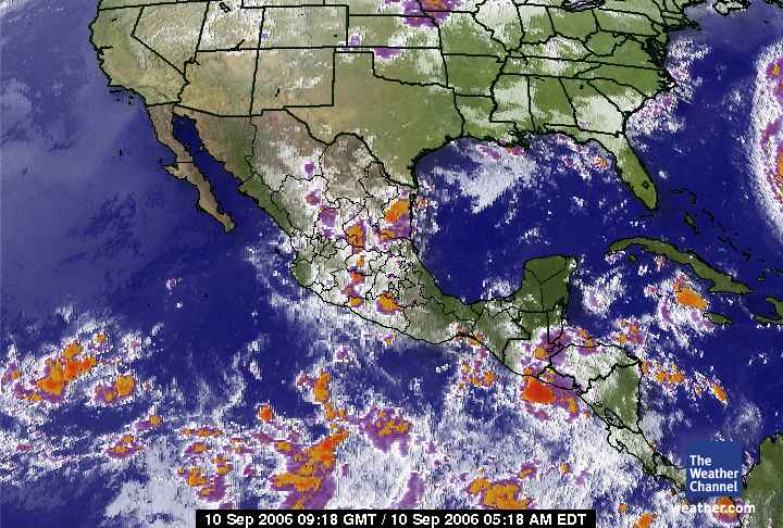
 September 10, 2006. 0918 gmt. Mexico Satellite.There are no storm currently in the East Pacific but a promise of one, in alignment with Florence, near San Salvador. When there is an excerbation of trubulence resulting in storms across the globe there is only once reason. That is the angle of the sun and the amount of solar radiation reaching Earth.
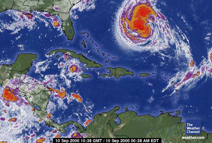
 September 10, 2006. 1038. Caribbean Sea Satellite. The swath of the storm is significant and will affect the east coast of the USA. It will of course turn north but the 'eye' which is currently at 976 millibars (A change of 16 millibars in the past six hours compared to a stable system over the past 72 hours which oscillated between 1003 and 992 central pressure.) and falling. This storm could accelerate quickly to a Cat 2 or low 3 before making landfall. The 'eye' may very well make landfall as high in latitude as the northeast area of New Jersey, New York and Long Island. It nearly doesn't matter because the rain bands will deliver the water to the entire east coast that will result in substantial flooding. There are currently no active storms in the Eastern Pacific but at about the same time Florence made Cat One a tropical depression showed up in the Western Pacific.
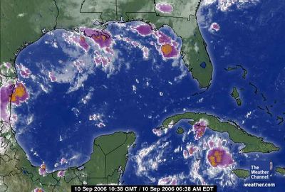 September 10, 2006. 1038 gmt Gulf of Mexico