This Blog is created to stress the importance of Peace as an environmental directive. “I never give them hell. I just tell the truth and they think it’s hell.” – Harry Truman (I receive no compensation from any entry on this blog.)
Wednesday, March 21, 2007
As a matter of fact the surface winds have increased significantly and it is easy to see where WAIS is receiving heat from. When examining closer the surface winds, they are highest at the lower elevations as the heavier air decends form The Blue Ice. It is these lower elevations where damage is done to the iceshelves and the ice terraces that protect the base of The Blue Ice. I don't believe any of this biotic damage should be taken by anyone lightly.
The jet stream is calm. It's boring. No real turbulence that we saw earlier. It's not carrying heat over the Blue Ice. Therefore, one has to come to some kind of conclusion in that when Vostok is at warmer temperatures, 'the heat transfer' over the Blue Ice is having an effect on the severity of the coldness in that location. In otherwords when the heat is carried by the Antarctica vortex over the Blue Ice there is a heat transfer that SUBLIMES the Blue Ice enough to cool the air mass causing it to become heavier than the surrounding air mass of the lower elevations and it' decends to the lower elevations.
Now, I also stated as the sun migrated to the north, hopefully the 'heat' over the Blue Ice would abate and this cycle would stop. I still am hopeful that will happen because the lower altitude reporting stations are not severely hot today, just yet. That could change quickly.
Base Orcadas, Antarctica
Elevation: 20 ft / 6 m
Temperature :: 36 °F / 2 °C
Conditions :: Overcast
Humidity: 73%
Dew Point: 31 °F / -1 °C
Wind: 23 mph / 37 km/h from the NW
Wind Gust: -
Pressure: 28.96 in / 981 hPa (Rising)
Visibility: 6.0 miles / 10.0 kilometers
UV: 1 out of 16
Clouds: Mostly Cloudy 1181 ft / 360 m
(Above Ground Level)
Click on for animation
March 21, 2007
12:00 PM
Antarctica
Vostok today is colder than early this week. Why? Where did all the heat go?
Vostok, Antarctica
Elevation: 11220 ft / 3420 m
Temperature: -76 °F / -60 °C
Humidity: 41%
Dew Point: -82 °F / -64 °C
Wind: 10 mph / 17 km/h / from the West
Wind Gust: -
Pressure: in / hPa (Falling)
Visibility: 12.0 miles / 20.0 kilometers
However, and this is a big however.
The jet stream would reveal a mixing of the high troposheric air masses that are directed toward the ice continent.
Now.
Why is it that the Blue Ice is heating and then WAIS. The heating on The Peninsula in the year 2007 is expected, El Calafate validates that. The latitudes of The Peninsula and Patagonia are very close to each other and are reflective of the Earth's tropospheric heating. But, what's this phenomena with The Blue Ice followed by the heating over WAIS?
Well.
The heat is therefore not directly connected with the surface of Earth, now is it. It is getting it's heat source at very high altitudes/elevations and 'decending' onto The Blue Ice.
I realize when Vostok is subzero Centigrade no one is seeing that as an issue with The Blue Ice but that is the wrong point of view. When Vostok is extremely cold the question still remains how 'VERY' cold is it.
Let's look.
Click on for animation
Australia
March 21, 2007
1:00 PM
When looking at Australia the pictures gets a little bit more ugly. The 'colors' of the heat currently over Antarctica reflects the heat seen over WAIS.
HOWEVER. And this is a big however.
There is no direct migration onto the Antarctica continent that DIRECTLY affects the shorelines or WAIS.
Mystery deepens.
El Calafate, Argentina is the Patagonian Ice Fields. The current conditions at El Calafate considering it's the Patagonian Ice Fields is not a pretty picture:
Longitude :: 50.3 South
Latitude :: 72.1 West
Temperature is 52 degrees F
Conditions :: Mostly Cloudy
Humidity :: 67%
Winds :: 23 mph WNW
Pressure :: 29:47 inches
Dew Point :: 41 degrees F
Visibility :: 6.2 miles
UV Index (Which is a common measurement in the southern hemisphere due to the Ozone Hole) :: 1 Low
March 21, 2007
11:00 AM Local Time
Click on for animation
GOES West
March 21, 2007
1330z
This is a massive system organized. The middle of the North American continent is not going to have a good day.
The vortex just south of Alaska, which is technically called 'The Arctic Oscillation' is actually anti-cyclonic. Oops. That's not good. One rarely sees an anti-cyclonic flow in the northern hemisphere yet one so dynamic and large. <
Click on for animation
March 21, 2007
1330z
UNISYS Hemispheric Water Vapor Satellite
The worst of it starts at the equator, passes over Panama, traverses Haiti and has it's vortex center circulation just east of Iceland. The vortex 'flow' then completes it's movement by passing south over The Greenland Ice and Laborador, Canada.
One more time before moving on. The hot spots today in the north are over high elevation ice formations
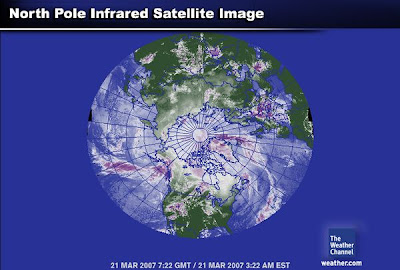
Northern Hemisphere
March 17, 2007
7:22 gmt
The greatest insult to Earth today is the heat tranfer from the equator DIRECTLY to The Greenland Ice. I'll see if I can find a better view of it.
Subscribe to:
Comments (Atom)


