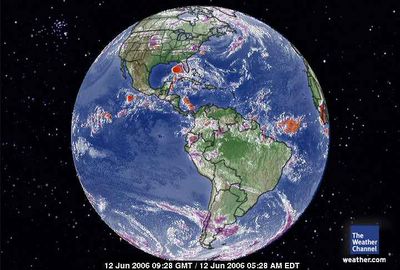
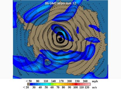
 June 12, 2006. 0928 gmt. Western Hemisphere. Noted the alignment of all the major turbulence of the Western and Norther Hemisphere reaches directly to the Arctic Vortex. There is no 'equatorial aire masse' over the Pacific until it meets agian with terra firma in South America. The 'pull' of the Arctic Ocean vorticity is signifant. It is literally pulling the hot equatorial air directly over the northern ice ocean to cool Earth. That is an incredible velocity of an Arctic Ocean Vortex to dominate Earth's climate so strongly. There is a whole lot of heat calories under the carbon dioxide. A lot !Human Induced Global Warming. The heat in the equatorial Atlantic between South Ameirca and Africa is not to be ignored either. That is where 'traditional' hurricanes can result. There is very, very healthy boundaries between the equator and Antarctica in the Southern Hemisphere.
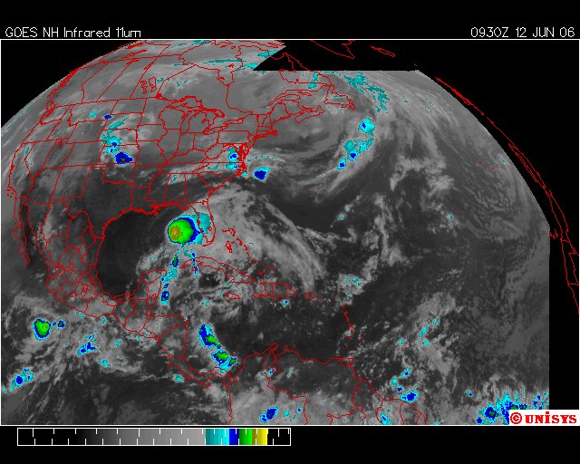
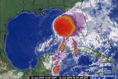
 June 12, 2006. 0930z. UNISYS GOES East satellite. There is another storm in the Pacific as there has been now with every major storm for two years now. The Pacific disturbance is in direct alignment with "Alberto." There is also significant heat building in the Caribbean Sea. To the north of "Alberto" the air disturbance over the Mid-West will bring difficult circumstances as well.
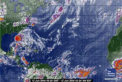 June 12, 2006. 0920 gmt.Tropical Atlantic Satellite.
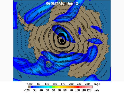
 June 11, 2006. Tampa, Florida.Storm 'track' on above link.
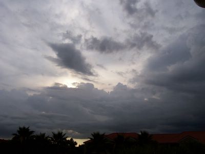
 June 11, 2006. Tampa, Florida. Photographer states :: some of the first bands of Alberto from Tampa
 The last time there was a storm named "Alberto" was the year 2000.
It showed on in August.
NOT JUNE !
 Alberto has shown up in the Northern Hemisphere and Antarctica has settled down to 'normal.' Could it be a complete reversal is on the way? This is an amazing satellite picture. Simply amazing. Normalcy in Antarctica climate. Will it last?
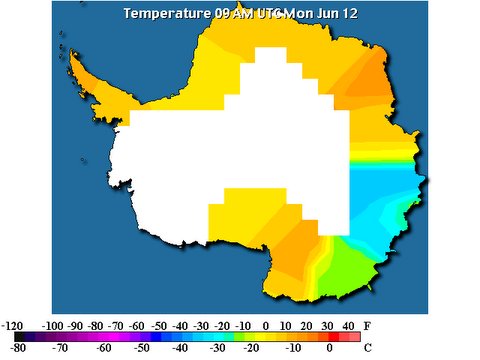 June 12, 2006 at 9 AM. Odd one. Almost universal temperature across the temperature map
.
The weather at Glacier Bay National Park (Crystal Wind Chime) is:
48 °F / 9 °C
Scattered Clouds
Humidity:
82%
Dew Point:
43 °F / 6 °C
Wind:
4 mph / 6 km/h from the ESE
Pressure:
29.99 in / 1016 hPa
Windchill:
47 °F / 8 °C
Visibility:
10.0 miles / 16.1 kilometers
UV:
0 out of 16
Clouds:
Scattered Clouds 900 ft / 274 m
(Above Ground Level)
The weather in Antarctica (Crystal Ice Chime) is:
Scott Base
Snow
-12.0°
Updated Monday 12 Jun 8:15PMend
Massive result, says Yorke DORTMUND – Dwight Yorke has played in many international matches and has won some of the biggest prizes in the game. But according to him, nothing could compare to yesterday's stunning 0-0 draw against Sweden in Trinidad and Tobago's opening World Cup match. "This is what football and dreams are all about," the captain said after the game. "To come up against a mighty footballing country of Sweden's status and obviously being a tiny country like ours. It's a massive result for us. Massive," said York who was named Player-Of-The-Match. Sweden are ranked 16th in the world and Trinidad and Tobago 47th. Yesterday, Hislop turned aside countless chances from the heavily favoured Swedes, and Yorke provided a steadying influence. http://www.nationnews.com/story/293617369897346.php