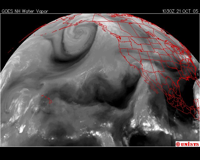
October 21, 2005. 1030 z.
GOES West Water Vapor satellite.
The North Pacific vortex is noted with a center south of Alaska.
The same disappearing act of the water vapor occurs over NA.
"Wilma" is noted in the right lower margin of the satellite picture.
Tropical Depression 16E is notedly oscillating to a minimum today and at this hour.
There are also convection 'heat' centers over Illinois and Pennsylvania and eastern Ohio.
Some storms distant south of Hawaii.
