This Blog is created to stress the importance of Peace as an environmental directive. “I never give them hell. I just tell the truth and they think it’s hell.” – Harry Truman
(I receive no compensation from any entry on this blog.)
Monday, March 13, 2006
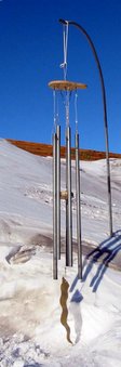
The Antarctica Wind Chime.
The weather in Antarctica (Crystal Ice Chime) is:
Scott Base
Snow
-16.0°
Updated Monday 13 Mar 9:59PM
The weather at Glacier Bay National Park (Crystal Ice Chime) is:
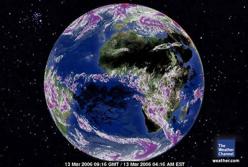
March 13, 2006. 0916 gmt. Europe-Africa Satellite. And the USA is blessed with a president without a conscience. Money is all Bush understands. Well, he has bought the entire global community a fine mess to straighten out. Quote, year 2003, "There is no such thing as Global Warming and carbon dixoide could never be a toxic gas." Absolutely no conscience. None. Kindly note the planet's affinity for 36 north latitude while the southern hemisphere is wildly shunting heat to Antarctica. What a mess.
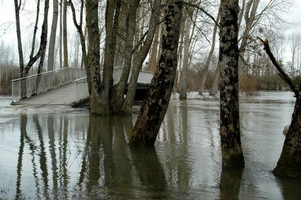
March 12, 2006. Vibrac, France. The birds in the foreground seem to like all the water.
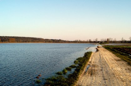
March 12, 2006. The River Charente, Angouleme, France. It's safe to say it's at flood stage.
As of March 3, 2006. These are the substantially frequent wildfires across the USA.
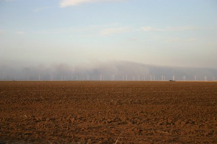
March 12, 2006. Wildfires across Panhandle, Texas.
Couple killed in tornado; more bad weather in forecast Published: 3/12/2006 11:37:50 AM ST. MARY, Mo. (AP) - A Missouri woman says she had just enough time to rush her family into the basement after a tornado warning sounded. Virginia Moore was lucky. Her house suffered only minor damage. But a husband and wife weren't as lucky. They were killed when their pickup truck was blown off Highway 61 near St. Mary, about 80 miles south of St. Louis. Officials say a twister hurled the truck beneath a roadside propane tank. Also near St. Mary, mobile homes were tossed about and a brick ranch house was split in half. Several people were injured. Across the Mississippi River in Illinois, a tornado damaged several homes and businesses in the small town of Fults. One person was hurt. More bad weather is in the forecast tonight. One meteorologist says it may even be worse than last night.
Tornado reported in Springfield; power out From Tribune staff and wire reports Tribune staff reporter Published March 13, 2006, 3:42 AM CST Severe storms across the Midwest packed winds that knocked over airplanes, ripped roofs off homes and spawned tornadoes that killed three people. In Illinois, a tornado caused widespread power outages and damage Sunday night to buildings on the south side of Springfield, according to a dispatcher with the Sangamon County 911 center, but he could not say if anyone was seriously injured.
Tornado Tears Through Benton County Homes Destroyed in Bentonville Ty Hampton carries a dog named "Dixie" belonging to his sister, Cara Conly, and brother-in-law, Clay Conly, out of their house Sunday, March 12, 2006, in the College Place subdivision in Bentonville. The Conly's home was one of several in the subdivision that received heavy damage from a tornado Sunday. None of the Conlys were injured in the tornado. The Morning News A full moon and stars shone through clouds late Sunday night, only minutes after the same sky produced a large tornado that tore across Benton County, damaging buildings and homes. The storm, which also brought large hail, strong straight wind and intense lightning, produced a twister that touched down near Gentry at 9:50 p.m. The storm then sped across the county at nearly 45 mph, damaging homes and buildings in Centerton, Bentonville, Little Flock and Avoca before moving off through Carroll County and into Missouri. In all, the storm lasted 45 minutes in Benton County. There was at least one confirmed injury at press time.
With tornado season here, Tuesday drill will remind us By PhillipO'Connor ST. LOUIS POST-DISPATCH 03/12/2006 After a year when weather patterns often dominated the nation's attention, Missouri and Illinois residents now have something new to look forward to climate-wise. Tornado season. On Tuesday afternoon, sirens will wail, schoolchildren will huddle in hallways and an electronic tone will be broadcast over television, radio and weather stations in Missouri. The annual springtime drill is designed to check emergency communication systems, but also to remind the public that we're entering a dangerous time of year.
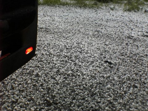
Tornado confirmed in Branson An F-0 tornado touched down around Branson on Saturday night downing trees and power lines, Doug Cramer, National Weather Service meteorologist, confirmed today. The tornado crossed over into southern Stone County, too. A survey team is assessing the damage and will have more information this evening. Cramer did not know of any injuries caused by the tornado. There were reports of damage caused by golf-ball size hail driven by winds in excess of 70 miles an hour, Cramer said. ?There were several people who experienced large hail that was driven into the siding of their homes,? Cramer said. ?Whenever you get hail that large and it?s driven by strong winds it makes it even more destructive, and that?s what was tearing up the homes.? More severe weather is expected today. ?There?s a potential for more development into Southwest Missouri today,? Cramer said. The National Weather Service has issued a tornado watch in effect until 10 p.m. for the following counties in the area: Barry, Barton, Cedar, Christian, Dade, Dallas, Douglas, Greene, Jasper, Laclede, Lawrence, McDonald, Newton, Ozark, Polk, Stone, Taney, Vernon, Webster and Wright.
Tornado Watches Issued For Most of North Central Arkansas Little Rock, AR - The National Weather Service (website/news) has issued tornado watch in effect until 10 pm this evening for 23 counties in Arkansas: In Central Arkansas: Conway Faulkner Perry Pope White Yell In Eastern Arkansas: Jackson Woodruff In North Central Arkansas: Baxter Boone Cleburne Fulton Independence Izard Marion Newton Searcy Sharp Stone Van Buren In Western Arkansas: Johnson Logan Scott A tornado watch means conditions are favorable for tornadoes and severe thunderstorms in and close to the watch area. Persons in these areas should be on the lookout for threatening weather conditions and listen for later statements and possible warnings. According to the National Weather Service, storms with very large hail and strong toviolent tornadoes are possible later this afternoon and evening. Storms are expected to move rapidly across Oklahoma into northwest Arkansas by late afternoon. Stay tuned to Channel Seven throughout the day for the very latest severe weather developments.
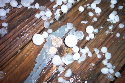
March 12, 2006, Hail the size of a quarter in Blue Springs, Missouri. Actually larger than a quarter.
Blue Springs, Missouri on March 12, 2006. No joke. Hail like this is very damaging and could be dangerous for people exposed to it.
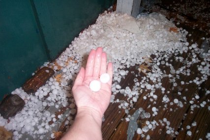
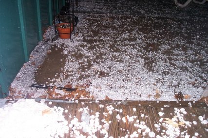
March 12, 2006. Hail continues to fall in Missouri.
March 11, 2006. Missouri tornado first touching down. Tornadoes pick up a solid appearence after they touch the ground for the most part unless there are dark and dense clouds that accompany it. The debris it creates makes it easy to see.
Hail accompanies tornadoes. This was March 11, 2006.
Kindly note the extremely similar appearence of the two 'systems' on the right of this image.
They are both vortices. One is over the Atlantic and the current weather system causing so much turbulence on the ground is over the Eastern USA.
That is somthing you won't hear from the national weather service.
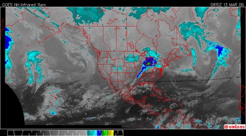
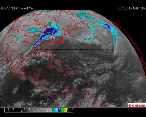
March 13, 2006. 0815z. GOES East Enhanced Infrared Satellite. The 'tornado' noted below is more easily visualized here. Also noted are the vortices in the North Atlantic, south of Greenland and Iceland.
March 13, 2006. 0815 Infrared GOES East Satellite. Quite a rather huge troposphereic tornado. Literally. The turbulence on the ground extends extremely high into the troposphere. This is not a first. There have been other such occurences but they have been over the oceans. One occurred last fall. It's here on the blog somewhere.
March 13, 2006. GOES West Infrared. The storm front extends all the way to the Mid-Pacific equator. The vortex south of Alaska is chronic. Has been for some time now.
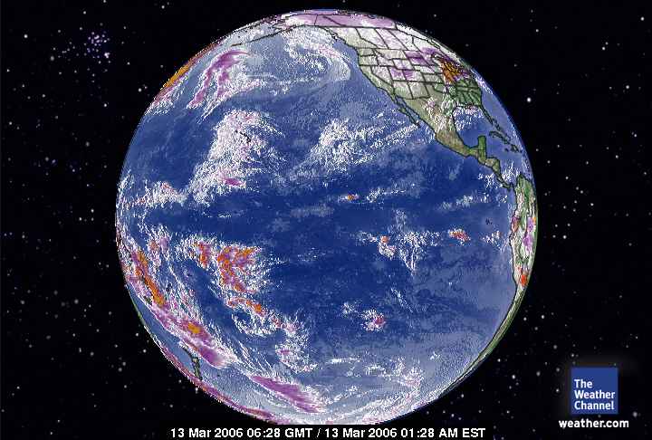
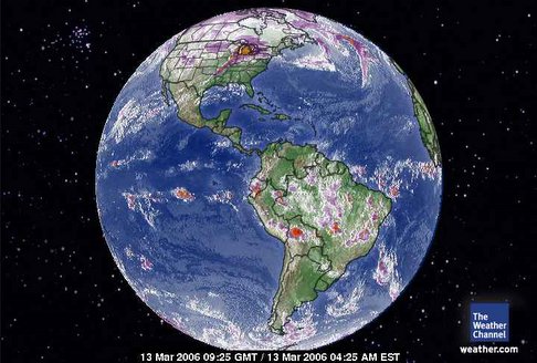
March 13, 2006. 0925 gmt. The Western Hemisphere.
Why does America trust each other more than their president? We don't lie as he does.
March 13, 2006 0628 gmt
Global Pacific Satellite
The air mass moving north can been seen here off the Mid-Pacific.
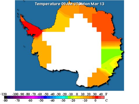
The southern hemisphere is just a mess. All that heat off the equator heading south is what is contributing to the Antarctica melt.
And Bush wants to talk, in series, about Iraq. "W"rong. A series of discussions should commence regarding Global Warming and Climate Change.
March 13, 2006. West Pacific Satellite. This is the equatorial region where the trubulent front causing chronic tornadoes ends. The heat movement off the equator south into Antarctica is huge. The solar radiation, of course is moving north above the equator and hence greater stability in the northern troposphere.