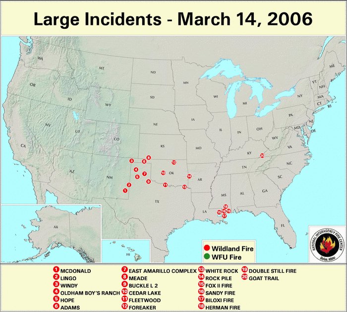
Wednesday, March 15, 2006


March 14, 2006.

Alanreed, Texas.

Photographer states :: More wildfires spread over the Texas Panhandle today. Fire warning are out again for tomorrow due to high winds. 11 people have died in Texas wildfires in the last 2 days.
Posted by Picasa


March 14, 2006.

Alanreed, Texas

Photographer states :: Texas is experiencing the worst wildfires in history. This fire was about 20 miles away from where I took the photograph. A half a million acres have already gone up in smoke. 11 people have died, 2 are missing, and fire warnings are out again for Wednesday with more high winds expected.
Posted by Picasa


March 14, 2006.

Alanreed, Texas.

Photographer states :: Part of the stretch along I-40 near Alanreed, TX where wildfires have claimed 1/2 million acres of land due to drought and high winds.

The trees in this instance will survive. The prairie fire never reached the canopy. The fact the bark at the truck of the tree is singed in irrespective to it's survival.
Posted by Picasa

The latitude of Alanreed is 35.212N. The longitude is -100.733W.


March 14, 2006.

Alanreed, Texas.

Photographer states :: Remnants and hot spots left from where a wildfire swept through this farmland in Texas last night. For about 25 miles for as far as the eye can see, the earth is scorched by fire.

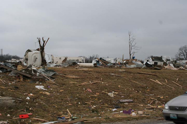
Noted. Where there was no prairie grass of the roadway the fire literally jumped the manmade fire line sparing the prairie grass on each side of the road. Fascinating stuff. The updraft from the fire storm literally sucked the fire up and over the road. The road is not scorched and I believe that is a puddle at the bottom of the gully. A person could have stood in the middle of that roadway and been perfectly safe from ever catching on fire. I would not try that without flame retardant clothing, but, if I was ever caught in such a set of circumstances, you'd find me sitting down in the puddle looking and listening for any traffic.


Posted by Picasa

The concentration of wildfires this week is below 36 North Latitude. (click on)


March 14, 2006. The fire map of the USA. Posted by Picasa

Carson's City, Missouri. Latitude 37.901390.


March 13, 2006.

The tornado aftermath at Carson's City, Missouri. These were RV storage sheds.

Noted there are no TWIGS on the trees. They have been stripped of all their small ancillary branches. The remaining branches are not capable of supporting any tree to life again. The chlorophyll in the bark of the tree will only supply a small amount of the nutrition they need. These trees need to be cut down.
Posted by Picasa

Smithton is a city in Pettis County. The latitude of Smithton is 38.68N. The longitude is -93.092W.


March 12, 2006.

Photographer states :: This storm ravaged thru Pettis County, MO in West Central MO. It had just tore thru a mobile home park where a woman was killed and was getting ready to pass over US hwy 65 Just South of Sedalia, MO. It continued in an East to Northeast direction and the Super cell it was generated from actually covered 6 states, spawned many tornadoes and lasted for over 17 hours! It was the same cell that caused damage in Springfeild, IL.

Here again the turbulence was do to a vortex that manifested it's fury in the vacinity of 36 North Latitude.

Posted by Picasa

The latitude of Skyforest is 34.235N. The longitude is -117.178W.


March 10, 2006.

Skyforest, California.

Photographer states :: first a little ice, then some snow...nice combination......(in moderation).....this was actually our first major snow...over a foot so far.....long overdue....

Must have been a very strong wind and very, very cold Arctic air to create such structures out of water.

The point of this picture is the Latitude and it's noted 'long overdue' status for snow. The Latitude 36 North hold true to the demarcation of drought verses drenching of the terra firma and oceans of the Northern Hemisphere. This is more proof of the same. Am I bothered by the fact this is 34.235 North rather than exactly 36 North. No. 36 North Latitude was always an estimate and the change there with some percipitation before the major tornado events of the Midwest is expected as the solar radiation migrates north again. The Vernal Equinox occurs on March 21st at 1:19 PM est, the first day of Spring. Posted by Picasa


March 12, 2006.

Proud Papa's exist in Copenhagen, Denmark. Needless to say this must be quite a pride of lions at this zoo. The cub in this picture is much younger than the ones below. Posted by Picasa


March 12, 2006.

The twins.

Copenhagen, Denmark. Posted by Picasa


A down to Earth Daddy.

How often do you see a male lion cuddling with his youngsters? Not very often. This picture was taken at the zoo in Copenhagen, Denmark on March 12, 2006. Posted by Picasa


A change of pace.

Recently an amateur astronomers found the wolves had something more to howl at than the moon. This is Saturn as seen through a Philips web cam and a Meade 12-inch LX200 working at 6096mm FL @ f/20. Approximately 1400 frames were captured and then the 20% best were sorted, aligned, and stacked using the freeware program, Registax 3.
Posted by Picasa