 December 3, 2006
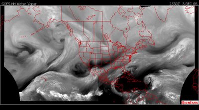
2330 z
The north and west hemisphere of Earth in a high resolution water vapor satellite. It shows a massive movement of heat energy off the equator to the Arctic Circle. Currently in the upper right corner of this satellite is a darker white cloud over Iceland. It is a vortex. There are multiple vortices above that heat transfer, bringing Arctic air to the continent. There are some red flag warnings for Southern California.RED FLAG WARNINGNATIONAL WEATHER SERVICE LOS ANGELES/OXNARD CA
308 PM PST SUN DEC 3 2006
...RED FLAG WARNINGS REMAIN IN EFFECT UNTIL 6 PM PST TUESDAY FOR
VENTURA COUNTY...THE MOUNTAINS AND VALLEYS OF LOS ANGELES COUNTY AND
THE SANTA BARBARA COUNTY MOUNTAINS FOR GUSTY OFFSHORE WINDS AND VERY
LOW RELATIVE HUMIDITY...
.OFFSHORE FLOW WILL CONTINUE ACROSS THE AREA THROUGH TUESDAY...
PRODUCING CRITICAL FIRE WEATHER CONDITIONS ACROSS MANY MOUNTAIN AND
VALLEY AREAS AND EVEN THE VENTURA COUNTY COASTAL PLAIN. THE OFFSHORE
WINDS WILL GRADUALLY DECREASE THROUGH TUESDAY. HOWEVER...RELATIVE
HUMIDITY WILL REMAIN IN THE LOW TEENS AND SINGLE DIGITS. WITH
EXTENDED PERIODS OF SINGLE DIGIT RELATIVE HUMIDITY EXPECTED...THE
RED FLAG WARNING WILL REMAIN IN EFFECT THROUGH TUESDAY EVENING.
PLEASE ADVISE THE APPROPRIATE OFFICIALS OR FIRE CREWS IN THE
FIELD OF THIS RED FLAG WARNING.
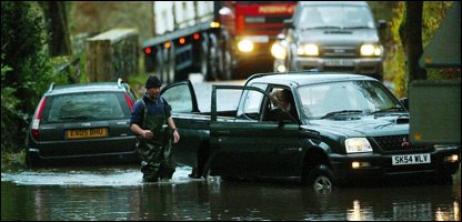
 December 3, 2006Great Britain Photographer states :: Rain and strong gales will continue to batter Britain after a stormy night which saw winds get up to 100mph. Forecasters said the weather would get slightly better, but southern Scotland, Northern Ireland and north-west England could see very strong winds. People in Scotland have been warned to prepare for flooding, and there is a risk of floods all over Britain. On Saturday night the south west of England was the worst affected area with winds leaving a trail of damage. A 47-year-old man died after being hit by a wave at Ardglass harbour in County Down, Northern Ireland. And some 12,000 homes don't have any power after the strong winds brought down electricity cables in the Midlands. On Sunday, winds could get up to 80mph, and up to seven and a half cm of rain could fall in some areas.
 December 3, 2006South Wales, United Kingdom Photographer states :: Severe weather currently in Britain. 100 mph hour gusts! and 60 mph hour winds have been recored in South Wales there is a risk of Flooding and maybe a ditrupition to travling and power today.
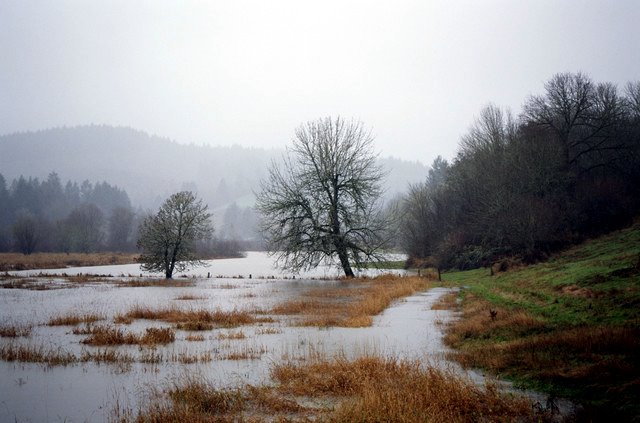
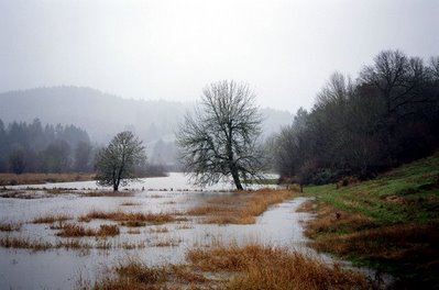
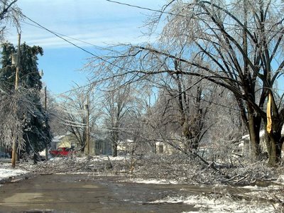
 December 1, 2006 Taylorville, Illiniois. The road at the bottom of the picture has already melted to water covered.
 December 1, 2006
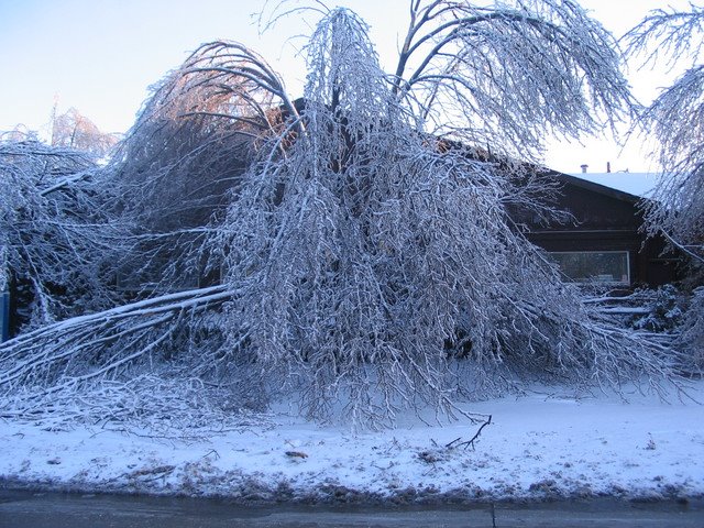
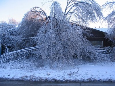
Taylorville, IllinoisThere is dry pavement already. In this picture where the snow plow has pushed the snow/ice from the road and below it can be noted dry areas on the road as the sun comes up. This is a Arctic storm. It belongs above the Arctic Circle.
Yep.
 December 1, 2006
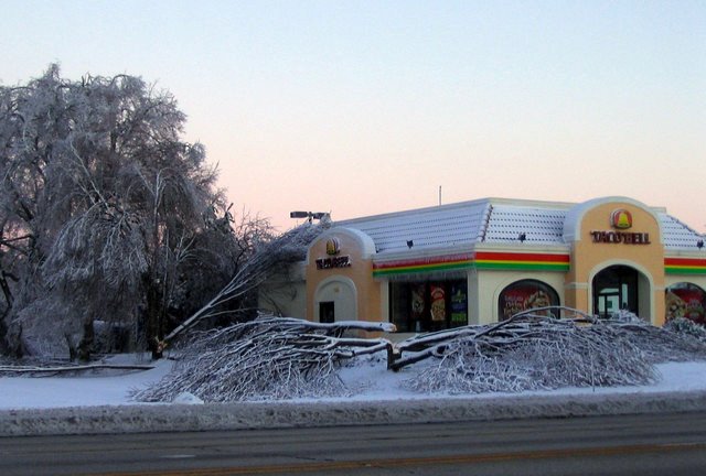
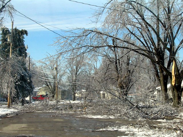
Taylorville, IllinoisPhotographer states : Just a mess ... This road will be closed for a long time. All power and phone lines were down and across the road, plus several trees.