October 21, 2005. 0930z.
GOES East Water Vapor satellite.
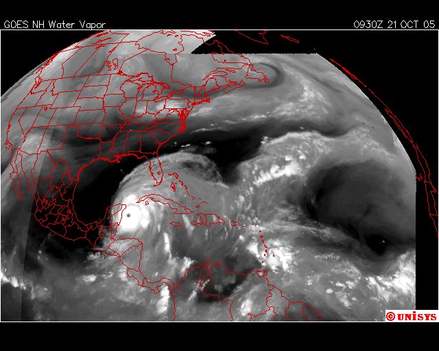
The dynamics are completely different.
The storm that is an 'eddy' to the Arctic Ocean vortex has a new 'vortex flow' that is feeding it's strength. The additional energy is coming directly from the equator AS WELL as being connected to the Artic Ocean. That additional energy flow manifested here in water vapor started as 'eddy 2' and has extended to the African continent where hurricanes traditionally have manifested.
NOTED :: There is a divot for lack of a better word, of dark area between the vortex street of sorts in the 'Northwest half of the NA Continent and the storm "Wilma." It is manifested here in the black area which is absent of water vapor. The reason it is absent of water vapor is because the storm is currently 'plowing' in that direction. In the direction of Galveston, Texas.
What is happening here is the North Arctic Circle vortex is 'lying down' one vortex flow after another next to each other. That is my estimate REALIZING I don't have super computers.
I am not surprised every computer tracking this stuff is going off task as they don't have this programming to enhance it's proper processing. These computers are programmed with OLD INFORMATION based on 'traditional hurricanes' and not Global Warming Eddies bring Climate Change.
