Monday, May 23, 2005


May 22, 2003. The product of the pasture land and farm community of Palencia, Spain. Posted by Hello

As of May 19, 2005 - The Bush/Cheney Plan for Rural America - Isn't Preserving it's Farmland - But, create Non-Farming Jobs.


May 13, 2005. Top soil of Indiana, the richest farmland in the nation of the USA blowing away in a three day wind event. Posted by Hello

CLICK ON TITLE ABOVE:

USDA ANNOUNCES INVESTMENT OF $15.4 MILLION IN BUSINESS DEVELOPMENT FUNDS FOR RURAL AMERICA

Funding to Create or Save Over 3,000 Rural Jobs/ 584 Rural Business Ventures

WASHINGTON, May 19, 2005-Agriculture Secretary Mike Johanns today announced the selection of 83 applicants in 29 states that will receive approximately $15.4 million in grants and loans for business development and job creation. The funds support President Bush's efforts to create jobs and improve economic opportunities in rural areas.

May 22, 2005. Palencia, Spain. Gate to pasture land. Posted by Hello

May 13, 2005. Third day of high wind stripping American farmland of it's topsoil. Posted by Hello

May 22, 2005. The Farmland of Palencia, Spain.  Posted by Hello

May 13, 2005. Indiana Dust Bowl. Posted by Hello

The Cheney Treasuries.  Posted by Hello

America and Americans, slaves to the Cheney Treasuries with an economy that does not work for them. Posted by Hello

May 23, 2005. Europe-Africa Satellite. Noted in this satellite the North Sea near Europe has a substantial vortex offshore. In the Southern Hemisphere the peripheral vortex flow reaches very high on the continent of South America connecting with the carbon dioxide concentration over the rain forest. This is a change due to an increase in the carbon dioxide levels over the USA with artifically depressed oil prices after the Saudi Prince visit for summer economic season of vacations. HUMAN INDUCED GLOBAL WARMING. "Proof !!" Posted by Hello

The heat dumped into Antarctica is non-existant over Africa compared to South America even with the summer solstice approaching.

May 23, 2005. A much quieter satellite than before. There is far less carbon dioxide in this portion of the world because the winds of both polar vortices more aire masses from east to west. In illustration of the increase in carbon dioxide pollution by the major polluter, USA with the summer vacation season, NOTED, 'hot spots' are noted with increased turbulence over Mid-North America Continent. The storms are worth it? Or. Simply a bad habit indulgent Americans can't seem to get over. These people have no 'brain trust' resources to live differently? Posted by Hello

The Western Hemisphere Satellite tells the tale.

The satellite below shows a great deal more turbulence in the troposphere than the satellite above. The reason for that is the fact the USA contributes 25%, a full one fourth, the majority, of the human produced Carbon Dioxide on Earth. The source will have a denser concentration over it's land than a non-source. That does not diminish the ultimate impact globally but it does create the INTENSITY of destruction in the immediate severity of the storms of Global Warming which has lead to Climate Change.

In the satellite below the South American picture is far gloomier than it's African counter part. The reason for that and why the Antarctica Vortex periphery reaches up to the equator over South America is due to AGAIN the CO2 concentration over the highest polluter on Earth. The carbon dioxide 'dump' from the continental USA creates high heat concentration along it's east coast. That in turn matches the heat index of equatorial Western Hemisphere. As a consequence the two air masses intermingle in it's identical heat index and consequently causes a larger CO2 load over the Amazon Rain Forest; along with the reality the rain forest, due to it's nature already has a naturally high CO2 level.

One might say this is a hideous idea, however, when comparing the jungles of Africa which sometimes exhibit higher than normal temperature indexes due to it's nature to 'suck up' CO2 there is NOT the same turbulence of both hemispheres, especially noted today.

The African satellite today in the Southern Hemisphere does not come close to the heat contribution to Antarctica of that of South America today.

The USA 'MUST' rein in it's use of carbon dioxide pollution otherwise such concentration will continue to cause 'acute' problems regardless of the quiet atmospheres of all other efforts of the countries of Earth. As other countries continue to make efforts to bring the Global levels of carbon dioxide down it becomes more and more evident there needs to be a United Nation's Mandate to all countries to achieve 1990 levels and not just the humanitarian countries of Kyoto.


May 23, 2005. You'll never hear the truth from NOAA or NASA as they are AT THE LEAST underprepared to make conclusions about the CURRENT Climate Change. In addition, for NOAA/NASA to actually speak to the issue would demand the USA to do something about it's carbon dioxide pollution. Has the oppression of knowledge by the USA government ever been more clear? Why? To control the public 'Mind Think.' Posted by Hello

May 23, 2005. GOES East of UNISYS. Three large storms and one small storm in the Climate Change of 2005. Posted by Hello

May 23, 2005. Burgeoning Storm developement with Climate Change. There is EASILY discerned three large systems and one small system along side the large heat concentration in the Mid-West North America. Posted by Hello

May 23, 2005. Tropical Atlantic Ocean. In a normal hurricane season the aire masse across the equator would move from Africa to North America. Climate Change has caused a large ionic vortices to dominate the climate of the world. These vortices distribute the heat to dissipate it. With the summer soltice one month from now the solar radiation is more intense in this area. Normally, in the past the hurricanes would be traveling to the Mid-Atlantic at this time. Now. The heat distribution is far different. The heat systems are still developed (as last year) at the 'eddies' of vortices but this year the peripheral flow of the Arctic Ocean Vortex is causing a travel of storms from east to west. The 'old' mechanism is still in existance but dominated by the ionic north vortex. IF the carbon dioxide level drops the ionic vortex will abate and the 'old' climate systems will remanifest. The lower gas prices in the USA for the economic time of Summer Vacation will cause, and probably already are as Memorial Day is nearly here, high carbon dioxide levels. I stated same would be an issue months ago. Posted by Hello

May 23, 2005. GOES East UNISYS satellite. Posted by Hello

May 23, 2005. GOES East UNISYS. Noted vortex center off north east north america. The heat centers are 'eddies' to this vortex. This phenomena was also noted with the repeated hurricanes from 2004 that traveled from Africa to North America along the tropical equator. This system building of 'eddies' may be storms of less intensity but same 'heat mechanism' at the hurricanes were before Climate Change with circulating north polar vortex. Posted by Hello

May 23, 2005. Infrared GOES West UNISYS. Posted by Hello

May 23, 2005. GOES West UNISYS satellite. The heat center in the Mid-West. An understanding of the burgeoning events that are spontaneous 'hot spot' of Global Warming.  Posted by Hello

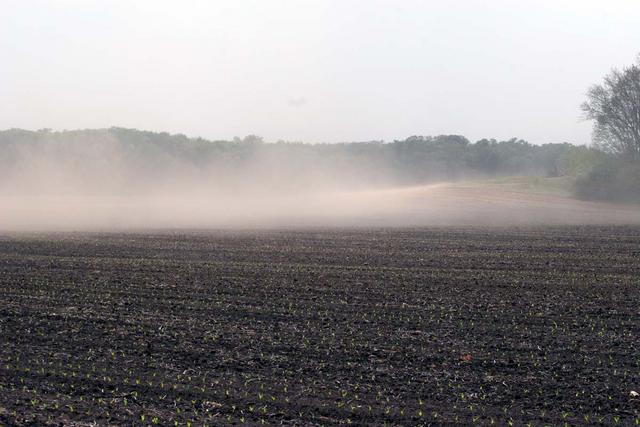
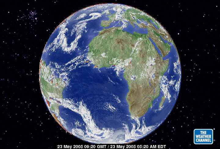
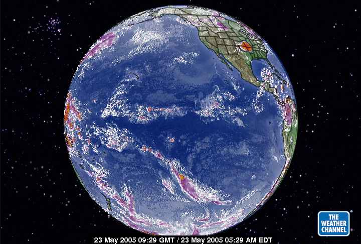
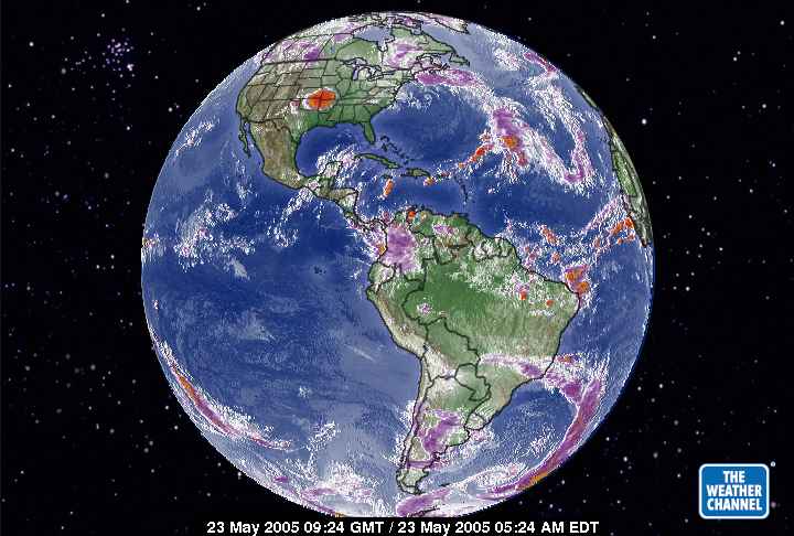
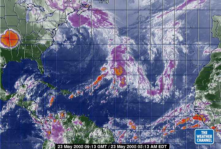
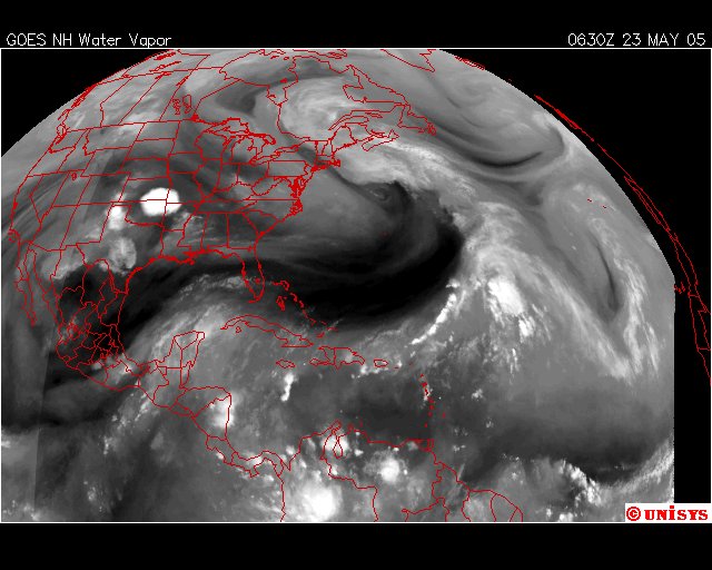
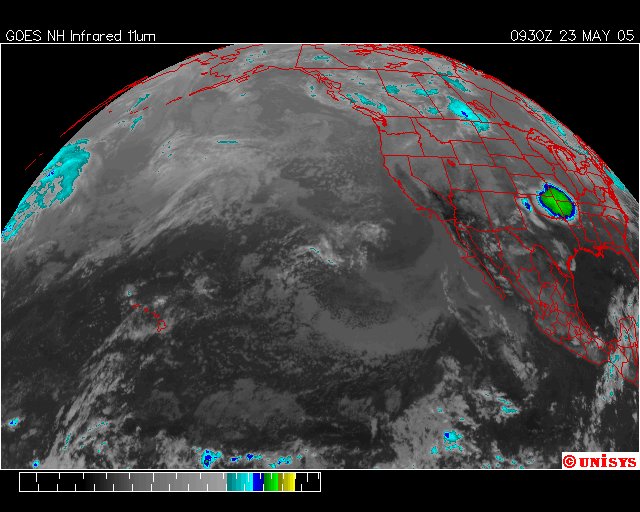
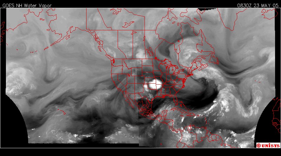
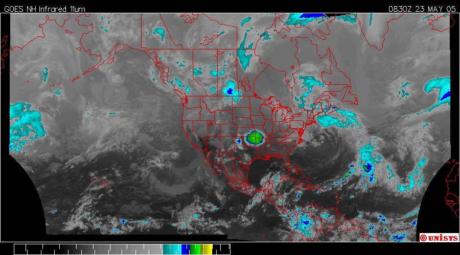
May 23, 2005. Heat center covering four states in the Mid-West.
68 °F / 20 °C Thunderstorm Rain

Humidity: 100%
Dew Point: 68 °F / 20 °C
Wind: 7 mph / 11 km/h from the South
Pressure: 29.93 in / 1013 hPa
Visibility: 7.0 miles / 11.3 kilometers
UV: 0 out of 16
Clouds (AGL): Mostly Cloudy 4700 ft / 1432 m Mostly Cloudy 6000 ft / 1828 m Overcast 7000 ft / 2133 m

 Posted by Hello

May 23, 2005. UNISYS Water Vapor. Heat concentration in the Mid-West. Posted by Hello

May 23, 2005. Midwest Storm covering four states in the MidWest. Posted by Hello