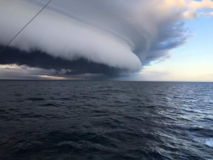
Hatteras, North Carolina
Photograph named "Cold Front"
That is a shelf cloud. It is the system now in the Atlantic east of North America.
That system reaches from the east Pacific Ocean crossing Mexico the ITCZ (Intertorpical Convergence Zone).
The travel zones of the Atlantic has to avoid these storms. It is something rarely if ever discussed.
 12 November 2015
1230:18z
UNISYS GOES East Water Vapor Satellite (click here for 12 hour loop - thank you)

00.00 utc
The red lines (click here) are systems causing trouble. The green lines are winds. The system that carried the shelf cloud into the Atlantic has the name "Kate" as a label.
That particular storm was considered the 12th name storm in the Atlantic. It had maximum category one storm.
 This is Kate's track.
November 12, 2015 (click here for satellite photo to left)
Great Britain has been receiving unrelenting storms one after another. This is not Kate, it is on it's way though.
The orientation to the map is at 11 o'clock is Greenland. Great Britain is directly under the convection system.