November 6, 2005.
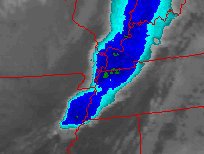
Enhanced Infrared of the Central Plains Satellite from UNISYS.
The 'green shaded' areas would be the more intense systems. Noted. The area in west Kentucky. This would have been about 30 minutes before the tornado touched down. From the descriptions it sounds as though this was a high incident F2 which is about a 150 mph vortex (tornado). This would track with the intensity of the storms of the Gulf of Mexico this season.
