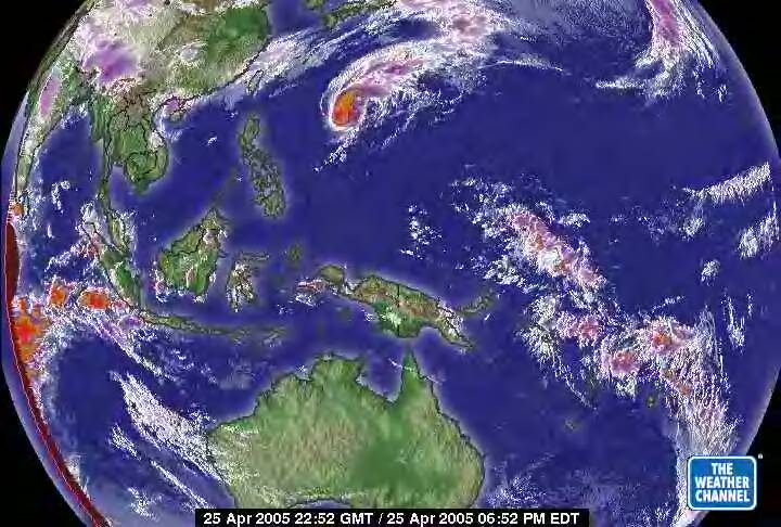
This is the April 25, 2005 satellite of the West Pacific Ocean. Noted the increased heat in the western margin of the satellite. However, ther overall picture is still much better than before. The heat decending into the ice continent is less intense and it completely relieved north of Australia at the equator. That has not been the case for over a year. This area is normally very active and this is an improved picture. The cyclone is noted north of Indonesia and will probably move into the North Pacific Vortex.
