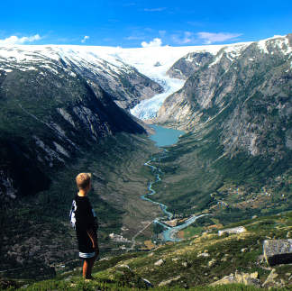
The picture is from Jostedalbreen National Park. (click here) Some of the glaciers are shaded by mountains, but, still, recede.
To understand the glacier retreat in this region of Norway, the Norwegian Glacier Museum and Ulltveit-Moe (click here) climate center has a display of its evidence.
Also, "Glacier Change in a world of Climate Change" (click here), it is a slightly more casual website that features more specifics that laymen may understand.
"A new glacier inventory for the Jostedalsbreen region, Norway, from Lanstat TM scenes from 2006 and changes since 1966"
by Frank Paul, Liss M. Andreassen and Solveig H. Winsvold
Annals of Glaciology, Volume 52, Issue 59, 2011, pp. 153-162, 14 September 2017
Pronounced changes (click here) in glacier mass and length were observed for the monitored glaciers in the Jostedalsbreen region, Norway, since the last glacier inventories were compiled in the 1960s and 1980s. However, the current overall extent of the glaciers in the region is not well known. To obtain this information, we have compiled a new inventory from two mosaicked Landsat Thematic Mapper (TM) scenes acquired in 2006 that have excellent snow conditions for glacier mapping, the first suitable scenes for this purpose after 22 years of imaging with TM. Drainage divides and topographic inventory parameters were derived from a 25 m national digital elevation model for 1450 glaciers. By digitizing glacier outlines from 1: 50 000 scale topographic maps of 1966, we calculated changes in glacier area for ~300 glaciers. Cumulative length changes for the 1997–2006 period were derived from an additional TM scene and compared with field measurements for nine glaciers. Overall, we find a 9% area loss since 1966, with a clear dependence on glacier size; however, seasonal snow in 1966 in some regions made area determination challenging. The satellite-derived length changes confirmed the observed high spatial variability and were in good agreement with field data (±1 pixel), apart from glacier tongues in cast shadow. The new inventory will be freely available from the Global Land Ice Measurements from Space (GLIMS) glacier database.