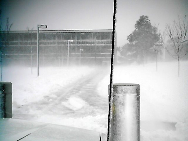
From the same photographer as below. This is during the 'blizzard.' It's a very good picture. It releases to me a severely cold Arctic Storm with a lot of freezing water in the direction of wind movement. Hence. Strong wind.
However.
The 'denser' water vapor is near the ground as opposed toward the second floor of the building. That mositure density could be fog near the ground where extremely cold air met with far warmer ground. So, why the freezing at all? Because water coming from the sky in the arriving storm is already frozen. It percipitated out of the storm as ice and snow. The items without the ability of 'heat retention' will become cold enough for frozen water to refreeze. However, the ground has a far higher heat retention than just the passing storm. It should not be a surprise when a storm this cold arrives over warmer ground that there might be fog.
