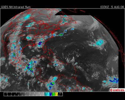
August 5, 2006.
0330z.
UNISYS Enhanced Infrared Satellite.
If one will kindly note the very LONG cloud mass that begins in Mexico with the center over the Yukatan and extends along the west coast of the North American continent ending at the Arctic Circle in Canada. It's an important dynamics and has been contributing to the instabilty of the climate in the Western USA causing flooding and rains.
This is an even earlier satellite of a so called dissipated Chris. It isn't. It reorganized to a certain extent over the islands. Both sides of the islands actually. My concern is that the 'heat budget' to Chris was dissipated INTO other areas of the heat budget of the vortex with a center over the Yukatan Peninsula. Mexico's Gulf Coast has been taking a beating because of what seems to me to be a resident vortex over the North American continent. Primarily centering it's energies (calories - heat calories) over the land mass we know as Mexico.
