Friday, September 02, 2005

UNISYS Water Vapor Satellite 12 hour loop - click here


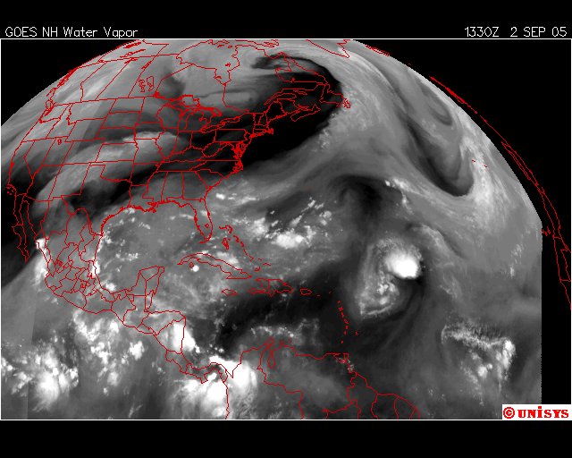
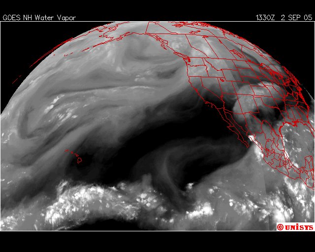
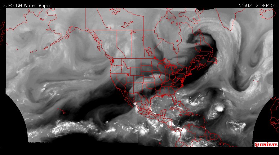
September 2, 2005. A huge vortex has consolidated over Northeastern Canada. It extends from the equator to the Arctic Circle. It extends from Hudson Bay across the Atlantic Ocean to the Greenland Ice. Tropical Depression 14 can easily be seen as the 'white' spot in the Atlantic. TD Fourteen is currently at 30 knots near 20.6N 48.1W . Currently it would seem TD 14 will not make landfall. The Gulf of Mexico is 'reasonably' quiet.
Posted by Picasa

September 2, 2005. UNISYS GOES East. Tropical Storm 14. Not expected to make landfall. Posted by Picasa

September 2, 2005. UNISYS GOES West.  Posted by Picasa

Morning Papers - concluded

The weather in Antarctica (Crystal Ice Chime) is:

Scott Base

Clear

-25.0°

Updated Saturday 03 Sep 1:59AM

The weather at Glacier Bay National Park (Crystal Wind Chime) is:

48 °F / 9 °C
Overcast

Windchill:
47 °F / 8 °C

Humidity:
87%

Dew Point:
45 °F / 7 °C

Wind:
4 mph / 6 km/h from the North

Pressure:
29.81 in / 1009 hPa

Visibility:
10.0 miles / 16.1 kilometers

UV:
0 out of 16

Clouds (AGL):
Few 200 ft / 60 m
Scattered Clouds 3300 ft / 1005 m
Overcast 4000 ft / 1219 m


end

What is a Levee?


The Mississippi River Basin.

Levees are not optional. Posted by Picasa

Hurricane Evacuation Routes


Mississippi Posted by Picasa

Know your state.

Know your evacuation routes.

HURRICANE KATRINA DISASTER INFORMATION


The Route 10 area of Waveland, Mississippi Posted by Picasa

Elevation: 17 feet


Waveland, Mississippi, USA. Posted by Picasa

Mississippi town 'wiped off the map'


August 30, 2005. Waveland, Mississippi. The 'eye' arrived here. Everything is gone. Pine trees have cellulose and bend in the wind. Very sparce leaves. Posted by Picasa

From above, coastal Mississippi resembles moon-like wasteland


August 30, 2005. Christian Pass and Waveland, Mississippi. Where the 'eye' of Katrina came inland. Posted by Picasa

August 30, 2005. New Orleans, Louisiana. Posted by Picasa

August 30, 2005. New Orleans, Louisiana. Posted by Picasa

August 30, 2005. New Orleans, Louisiana. Looking for survivors. The passenger view. Heartbreaking work. Who do you save first? Posted by Picasa

August 30, 2005. New Orleans, Louisana. Caption :: I work for Louisiana Wildlife and Fisheries. We are in search and rescue mode. This was my first view of 9th ward when I got to the top of the St. Bernard Bridge. The water was 9' deep and deeper.
 Posted by Picasa

August 30, 2005. New Orleans, Louisiana. Posted by Picasa

August 30, 2005. New Orleans, Louisana. Posted by Picasa

August 30, 2005. New Orleans, Louisiana. Posted by Picasa

August 30, 2005. New Orleans, Louisiana. Posted by Picasa

August 30, 2005. New Orleans, Louisiana. Posted by Picasa

August 30, 2005. New Orleans, Louisiana. Posted by Picasa