
1930.18z
UNISYS Water Vapor Satellite of the North and East Hemisphere (click here for 12 hour loop - thank you)
I checked this satellite about 7 AM today and I thought for sure it would be out of the Gulf of Mexico by now.

1930.18z
UNISYS Water Vapor GOES East Satellite (click here)
I am not so sure that is even a vortex so much as a tropospheric tornado. It has enormous size. That system has depth and width that stretches out into the Atlantic.
May 1, 2017
By Mika Miyashima
Honolulu (click here) - The Daniel K. Inouye International Airport in Honolulu recorded a record low temperature of 61 degrees Sunday morning. That beats the record low of 63 degrees set in 1995.
"There are a couple of different systems that are combining to affect our weather. One is a big upper level disturbance which is diving down from the north across the islands today, and then the other one is an old stationary front which is down by the big island." Said Robert Ballard, Science and Operations Officer at the National Weather Service.
The National Weather Service says it's the combination of those two weather systems that's bringing the rain and cool weather.
In the last 24 hours, Maui has seen the most rainfall.
"They've had anywhere between 3 and 7 inches, a couple spots maybe even heftier than that." Said Ballard.
On Oahu, the Honolulu Zoo was closed for the day due to the wet weather....
That accumulation of water vapor creating a structure over Hawaii is new. It is extremely rare.
 1 May 2017
1930.18z
UNISYS Water Vapor GOES West Satellite (click here for 12 hour loop - thank you)
April 30, 2017
By Jobeth Devera
...And on Maui, (click here) the torrential rain left parts of South Kihei Road underwater near the Maui Lu Resort.
That accumulation of water vapor creating a structure over Hawaii is new. It is extremely rare.

1930.18z
UNISYS Water Vapor GOES West Satellite (click here for 12 hour loop - thank you)
April 30, 2017
By Jobeth Devera
...And on Maui, (click here) the torrential rain left parts of South Kihei Road underwater near the Maui Lu Resort.
A landslide covered Kahekili Highway near mile marker 11 and crews were out in the rain over on the east side near Kaupo fixing a large sinkhole.
At Kaupo Gap, Piilani Highway remains closed due to water flowing over the road....
May 1, 2017
By Kelly Simek
The National Weather Service (click here) has issued a flood advisory for Hawaii Island until 8:30 a.m. Monday.
At 5:25 a.m., the radar showed showers and thunderstorms streaming over the Big Island from the southeast, affecting the area from near South Point to Cape Kumukahi to Hilo.
Additional heavy showers are poised to move ashore through the morning. Rainfall rates between one and two inches per hour can be expected in the heavier showers.
Locations in the advisory include but are not limited to Hilo, Kailua-Kona, Hawaiian Paradise Park, Captain Cook, Honokaa, Paauilo, Naalehu, Orchidlands Estates, Pepeekeo, Kawa Flats, Pahoa and Pohakuloa Camp.

Stay away from streams, drainage ditches and low lying areas prone to flooding. Rainfall and runoff will also cause hazardous driving conditions due to ponding, reduced visibility and poor braking action.
 Do not cross fast flowing or rising water in your vehicle, or on foot
This advisory may need to be extended beyond 8:30 a.m. if heavy rain persists.
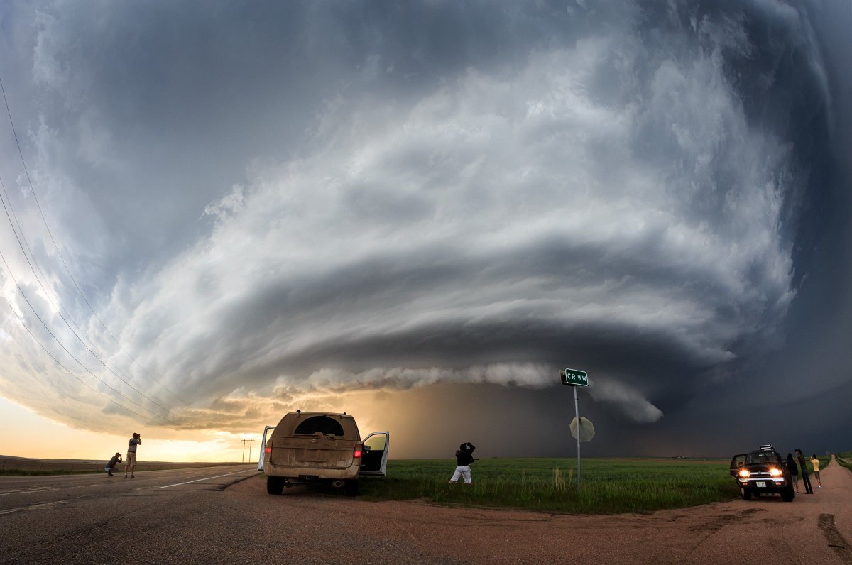
Tornado season officially starts June 1, 2017. There is a shift east of the density in the number of tornadoes.
May 1, 2017
By Kelly Simek
The National Weather Service (click here) has issued a flood advisory for Hawaii Island until 8:30 a.m. Monday.
At 5:25 a.m., the radar showed showers and thunderstorms streaming over the Big Island from the southeast, affecting the area from near South Point to Cape Kumukahi to Hilo.
Additional heavy showers are poised to move ashore through the morning. Rainfall rates between one and two inches per hour can be expected in the heavier showers.
Locations in the advisory include but are not limited to Hilo, Kailua-Kona, Hawaiian Paradise Park, Captain Cook, Honokaa, Paauilo, Naalehu, Orchidlands Estates, Pepeekeo, Kawa Flats, Pahoa and Pohakuloa Camp.

Stay away from streams, drainage ditches and low lying areas prone to flooding. Rainfall and runoff will also cause hazardous driving conditions due to ponding, reduced visibility and poor braking action.
 Do not cross fast flowing or rising water in your vehicle, or on foot
This advisory may need to be extended beyond 8:30 a.m. if heavy rain persists.
Tornado season officially starts June 1, 2017. There is a shift east of the density in the number of tornadoes.