
North America is at the center of this satellite image. It is an infrared image.
March 17, 2012
1745 utc
The satellite shows a major heat transfer system over the Pacific. The system is trapping the air over Alaska into a cycle of chronic storms and that is why the snow storms are as substantial as they are with growing snowfall.
 March 17, 2012
1556 utc

1556 utc
The bottom of this infrared image from today shows clearly the heat transfer in the Pacific and the NON-interaction with air masses over Alaska.
 March 18, 2012
0030z
UNISYS Infrared GOES West Satellite
 And for clarity:
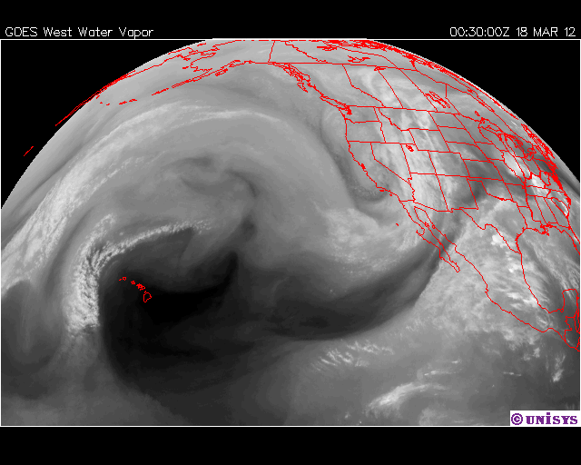
March 18, 2012
0030:00 z
UNISYS Water Vapor GOES West Satellite (click here for 12 hour loop)

0030z
UNISYS Infrared GOES West Satellite
March 18, 2012
0030:00 z
UNISYS Water Vapor GOES West Satellite (click here for 12 hour loop)
The reason there is so much percipitation is because there is equatorial moisture condensing over the Arctic.
Alaska's largest city eyes snow record (click title to entry - thank you)
By RACHEL D'ORO
Published: Saturday, March 17, 2012 at 5:18 a.m.
Last Modified: Saturday, March 17, 2012 at 5:18 a.m.
ANCHORAGE, Alaska - A near-record snowfall this winter has buried Anchorage neighborhoods, turning streets into snow-walled canyons and even collapsing some roofs.
But some residents are hoping for more, at least another 3.3 inches. Then they could say they made it through the winter when the nearly 60-year record of 132.6 inches was broken.
"I want it destroyed," resident Melissa Blair said. "I want to see another foot and knock that record out of the park."
Even by Alaska standards, this winter is unusual for the hardy residents of the state's largest city. But extreme weather isn't just affecting Alaska, it has also hit the Lower 48....