Wednesday, September 21, 2005


September 20, 2005. The rate of rainfall as seen by a NASA/NOAA satellite as it approached The Gulf of Mexico. Posted by Picasa

September 19, 2005. "Rita" Cuba lies to the west at this point.  Posted by Picasa

September 17, 2005. Early stages of "Phillipe." Posted by Picasa

September 21, 2005. The Northern Hemisphere. View from above the Arctic Ocean. Easily discerned is the ice sheet of Greenland. "Rita" is at five-thirty on a clock face at the periphery. "Phillipe" is at four o'clock. Posted by Picasa

September 21, 2005. The carbon dioxide levels over the USA is literally pulling the east-west aire masses north where the highest turbulences are beginning over Central America. Beginning with the Pacific side and extending to the northern border of South America these air masses move fluidly with the ionic strength of the Arctic Ocean Vortex.  Posted by Picasa

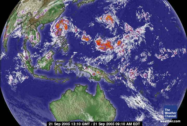
September 21, 2005. Western Pacific Ocean.  Posted by Picasa

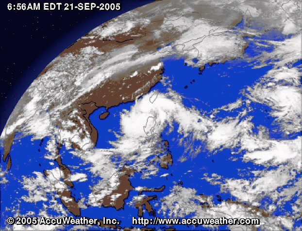
September 21, 2005. East Asia Northern Hemisphere satellite. Posted by Picasa

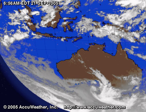
September 21, 2005. Southern Australian Hemisphere. Posted by Picasa

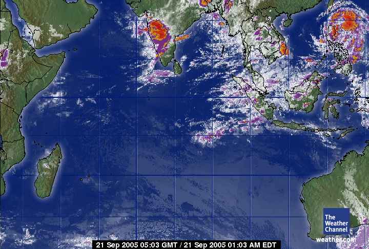
September 21, 2005. The Indian Ocean. Posted by Picasa

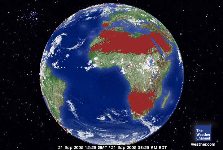
September 21, 2005. The African European Satellite. It's hot over the deserts of Africa and the Middle East. No major storms for the continent void of industrial carbon dioxide emmisions in large measure.. Posted by Picasa

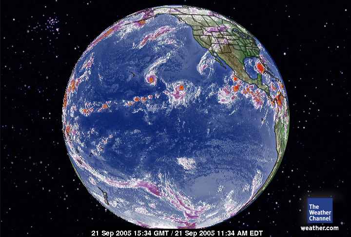
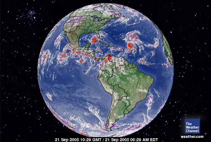
September 21, 2005. The Western Hemisphere. Posted by Picasa

September 21, 2005. The Southern Hemisphere satellite. Posted by Picasa

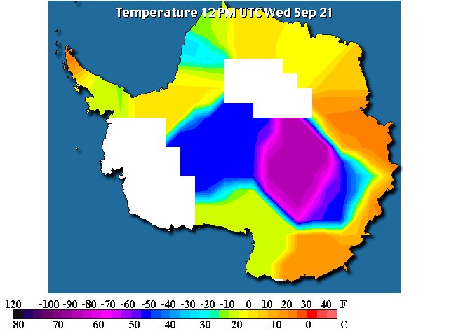
September 21, 2005. Temperatures across Antarctica. Posted by Picasa

Morning Papers - concluded

Weather in Antarctic (Crystal Ice Chime) is:

Scott Base

Clear

-23.0°

Updated Thursday 22 Sep 1:59AM

Weather at Glacier Bay National Park (Crystal Wind Chime) is:

46 °F / 8 °C
Overcast

Humidity:
87%

Dew Point:
43 °F / 6 °C

Wind:
Calm

Pressure:
30.23 in / 1024 hPa

Visibility:
10.0 miles / 16.1 kilometers

UV:
0 out of 16

Clouds:
Few 1200 ft / 365 m
Overcast 6000 ft / 1828 m
(Above Ground Level)


end

Operation Antarctica


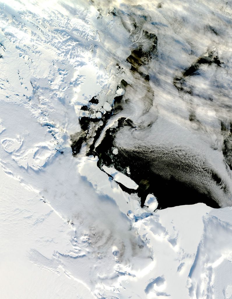
The dispution of Summer at McMurdo Sound. Posted by Picasa

B-15A Iceberg Blocks McMurdo Sound


December 13, 2004. McMurdo Sound. Posted by Picasa

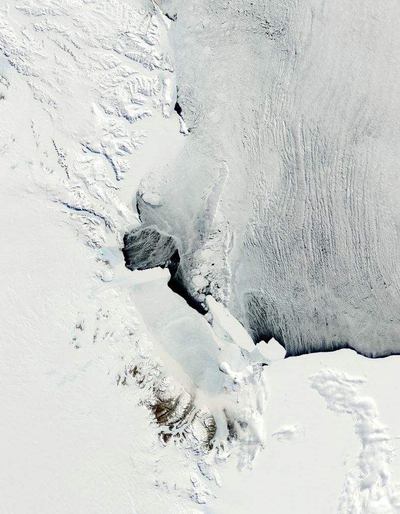
Antarctica - A Battle with Bergs


November 9, 2004. McMurdo Sound. Posted by Picasa

The USA under Bush has a need for technology established for Third World Nations

SATELLITES USED TO HELP PREDICT DEADLY DISEASE OUTBREAKS

NASA is providing new insights from space that may help health officials predict outbreaks of deadly water-borne cholera, a bacterial infection of the small intestine that can be fatal to humans.

Scientists have learned how to use satellites to track blooms of tiny floating plant and animal plankton that carry cholera bacteria by using satellite data on ocean temperatures, sea height and other climate variables. The work is described in a recent paper co-authored by University of Maryland Biotechnology Institute (UMBI) and NASA researchers that appeared in the Proceedings of the National Academy of Sciences.

"These experiments fulfill our hypothesis that cholera is associated with environmental conditions," said Dr. Rita Colwell, founder and former president of UMBI, and now Director of the National Science Foundation. She is presently on leave of absence from the University of Maryland, and is co-author of the cholera- tracking project paper.

The authors found that rising sea temperatures and ocean height near the coast of Bangladesh in the Bay of Bengal from 1992 to 1995 often preceded sudden growth, or "blooms," of plankton and outbreaks of cholera. Similar application of risk analysis developed by NASA using satellite data has also been used in the study of diseases such as malaria, Lyme disease and Rift Valley fever.

The ARTICLE CONTINUES ....

Demystifying a Storm - I hate oppression. In the media increased commercial interruption is a passive FORCED oppression of relivant information.

There are several ways of identifying the intensity of a storm when it is a convection center (A Spinning Storm with 'an eye.')

On a local level when a storm is approaching it can be detected by a barometer. If a storm is across the nation it won't be possible to detect it's severity for friends and family by a barometer.

Storms are measured by wind speed and pressure in millibars. There are correlations between the two that classify the severity of storms.

Shall we:

One Knot = 1.15077945 miles

Google Calculator: http://www.google.com/help/features.html#calculator

Type of Storm .............Wind Speed in Knots....................................Pressure in Millibars

Tropical Depression ....Less than 34 ................................................ Not Measured

Tropical Storm .............34 to 63 knots ..............................................Not Measured

Hurricane Cat One ......64 to 82 knots ..............................................Greater than 980 millibars

Hurricane Cat Two .....83 to 95 knots ..............................................965 to 980 millibars

Hurricane Cat Three ..96 to 112 knots ............................................945 to 964 millibars

Hurricane Cat Four ....113 to 135 knots ..........................................920 to 944 millibars

Hurricane Cat Five .....Greater than 135 knots...............................Less than 920 millibars

Yes, the speed of a storm is inverse to the it's pressure. The lower the pressure the more dangerous the storm.

The issue of proportion of commercials to 'subject' time on the USA airways is limiting the CONTENT of the news networks. Filling the airways with more and more commercials increases the PROPAGANDA of the government and industry and less information about the world and its interactions with the USA. This is an administration struggling AGAIN for control of it's image while fighting wars abroad and at home. A broad against the sovereign nations it has invaded, ie: I sight the British aggression against a Basra jail and in Afghanistan the wish of President Karzi for the foreign forces to leave his country. Domestically Bush is desperately fighting a war AGAINST Global Warming with the repeated storms in the Altantic and Gulf. He has gotten so desperate to maintain his oil focus that The National Hurricane Center is making up phenomina that it's director is stating is a cyclical dedade or two natural event.

If that were the case this would be 'old hat' and not alarming events. The USA lies chronically about environmental issues increasing the danger to citizens. I am used to this under this administration. When the manifestations of end stage Global Warming first manifested in October 2002 the National Weather Center came up with all kinds of phenomina but never the actual issue.

http://www.earthrescue911.org/er_founder_statement.pdf

I've been through this idiocy before.

Bill Clinton's new Global Initiative has the right idea. If Global Warming was insignificant it would be irrelivant. Global Warming is an issue globally that causes suffering and death.

Tuesday, September 20, 2005


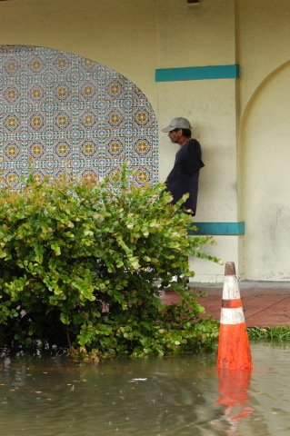
September 20, 2005. Waiting out "Rita" in Miami. Posted by Picasa