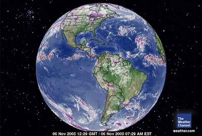
 November 6, 2005. 12:29 gmt. Western Hemisphere Satellite.
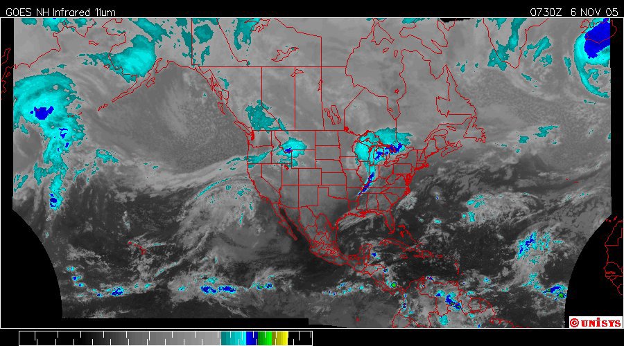
 November 6, 2005. 0730 z. Enhanced Infrared Hemispheric Satellite by UNISYS.
 November 6, 2005. Water Vapor GOES East Satellite by UNISYS. NOTED : There is significant convection in the Caribbean Sea as well. The North Atlantic Vortex is still present but 'moved off' to the east of Greenland. Current reports of authority at Weather Centers in the area of the incident in Kentucky/Illinois is stating the vorticity is initially assessed at 150 to 160 mph. The upper levels of a F2 tornado is 157 mph. The authorities in the area are calling this an F3. If there is a difference for people in filing insurance claims and the like including FEMA is would be far better to classify the incident at a higher Fujita Scale number as there is a (+/-) error in any reporting. So given any error to the higher scale the residents should have the benefit of the higher scale.
 November 6, 2005. Steven Auten and his mom, Shelley from Newburgh, Indiana. People will possibly face the effects of Post Traumtic Stress if not grief from loss of loved ones. Pets may be missing as well. They could be missing owners as well and wandering without supervision. Their 'normal' safety is compromised as well by the same impacts as people with downed power lines and dangerous debris. There were also deaths of 5 out of 150 horses at a Kentucky farm/track (Ellis Park). The financial impact is only one aspect of incidents like this.
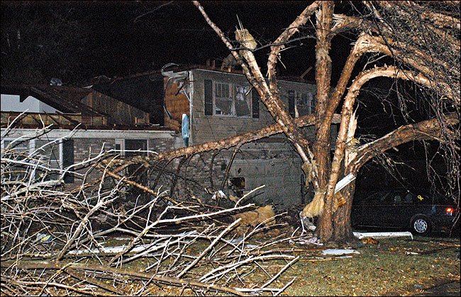
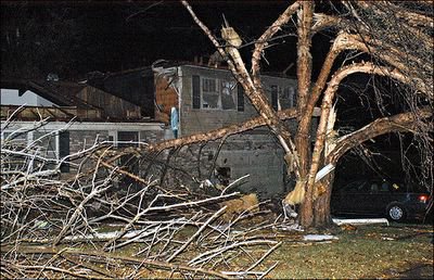 November 6, 2005. The New York Times has captured the essence of this storm which is a classic but high level F2 tornado. Snapped trees. Roofs ripped off well constructed buildings. This is a home with people who believe in compassion. They have a 'pink ribbon' on the windshield of the car. The walls of this home is still standing. There is no guarantee what happened to the occupants of this home and given the fact their car is still in the driveway it is safe to say they haven't left the area.
Tornado Rips Through Indiana and Kentucky
By THE ASSOCIATED PRESS
Published: November 6, 2005
Filed at 10:01 a.m. ET
EVANSVILLE, Ind. (AP) -- Fifteen people are confirmed dead after a tornado hit southwestern Indiana, the state's homeland security spokeswoman said Sunday.
The tornado ripped across southwestern Indiana and northern Kentucky early Sunday, wrecking homes and knocking out power to thousands, authorities said
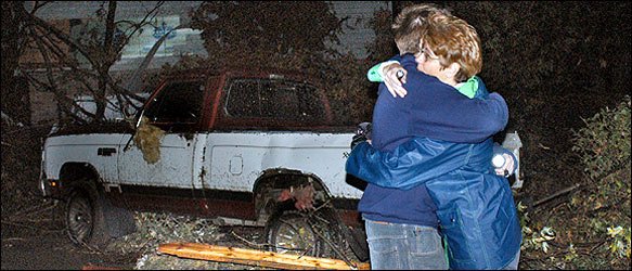
Cecelia Hanley/Associated Press
A house in Newburgh, Ind., was damaged by the tornado.
Witnesses say the tornado touched down near Henderson, Kentucky, and hopped across the Ohio River into Indiana at around 2 a.m.
Vanderburg County sheriff's dispatcher Diane Duvall said five people were killed at the Eastbrook Mobile Home Park on the southeast side of Evansville.
Henderson County sheriff's dispatcher Michelle King said no deaths were reported in Kentucky.
At the Ellis Park racetrack between Evansville and Henderson, the Henderson County Sheriff's department said about half of the track's grandstands had been destroyed, along with horse barns and housing units.
http://www.nytimes.com/aponline/national/AP-Midwest-Tornado.html?hp&ex=1131339600&en=6afaf48f609b3677&ei=5094&partner=homepag
Deadly tornado rakes Kentucky and Indiana
At least 15 deaths reported; mobile home park severely damaged
Updated: 10:03 a.m. ET Nov. 6, 2005
EVANSVILLE, Ind. - A tornado ripped across a wide swath of southern Indiana and part of northern Kentucky early Sunday, killing at least 15 people, wrecking homes and knocking out power to thousands, authorities said.
Witnesses said the tornado touched down first near Henderson, Ky., and hopped across the Ohio River into Indiana at around 2 a.m.
The Eastbrook Mobile Home Park on the southeast side of Evansville was heavily damaged. Five people were killed there, said Diane Duvall, a dispatcher at the Vanderburg County Sheriff's office.
http://www.msnbc.msn.com/id/9942171/
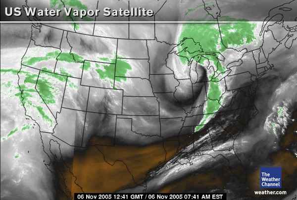
 November 6, 2005. 1241 gmt. Water Vapor satellite over USA a little less than six hours post 'touchdown.'
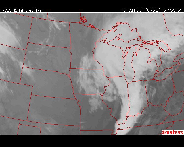
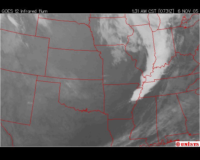
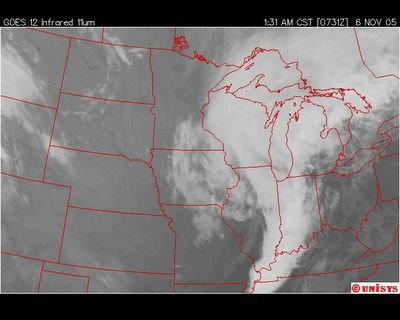 November 6, 2005. 0731 z. Infrared of the Midwest Satellite from UNISYS. The 'briefness' of this storm whether categorized as a tornado or a down-blast is not at all unusal for this 'incidents' due to vortices of global warming. It has been my experience this is 'typical' of these 'incidents.' It is a build up of 'heat'/energy/calories that is relieved only by the intensity of interaction with cooler air that results in the air at ground level finding devastation among civilization. I hope that doesn't sound to bizarre. It's sort of a 'molecular' evaluation. In other words what's the geophysics of the moment? Micromanagement of a tornado/downblast ain't simple.
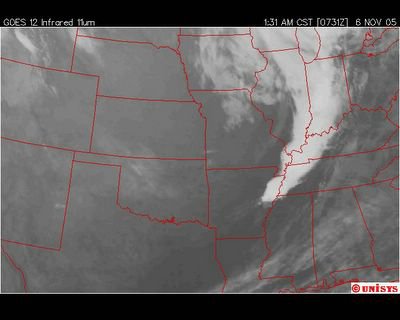 November 6, 2005. 0731 z. Infrared Central Plains Satellite from UNISYS. There are a very few homes with missing constructed walls. It could have been an F3, but, probably a low level F3 if at all. I am not seeing that type of damage wide spread.
 November 6, 2005. 0731 z. Enhanced Infrared Midwest Satellite of UNISYS.
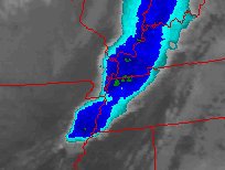
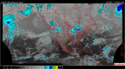
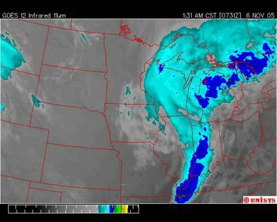
 November 6, 2005. 0731 z. Enhanced Infrared Central Plains Satellite of UNISYS. A Fujita 2 tornado is considered a significant tornado. The strength of it's vorticity is between 115 to 157 mph. Description of damage: Considerable damage. Roofs torn off frame houses; mobile homes demolished; boxcars pushed over; large trees snapped or uprooted; light object missiles generated. The next scale up would be an F3 but would include uprooted trees and constructed walls torn off. I am not seeing that higher level of destruction. There can be deaths of people if they are asleep in their beds at 150 or so mph vorticity. It might be a higher level Fujita rating but a high level F2 is my first impression. It really doesn't take a monster tornado to kill people. Sorry.
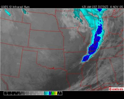
 November 6, 2005. Enhanced Infrared of the Central Plains Satellite from UNISYS. The 'green shaded' areas would be the more intense systems. Noted. The area in west Kentucky. This would have been about 30 minutes before the tornado touched down. From the descriptions it sounds as though this was a high incident F2 which is about a 150 mph vortex (tornado). This would track with the intensity of the storms of the Gulf of Mexico this season.
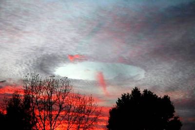
 Enhanced view of picture below.
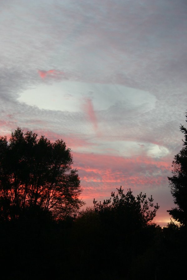
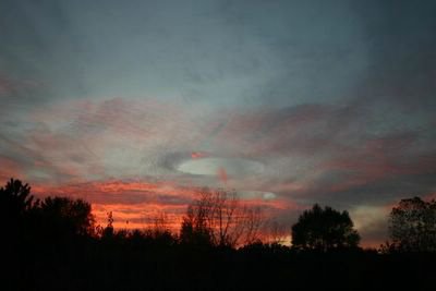 November 3, 2005. Brighton, Michigan. This vortex eventually spawned fatal tornadoes in Illinois and Kentucky.
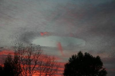
 Enhanced View of picture below.
 Center of developing and deadly vortex on November 3, 2005 over Brighton, Michgan.
 Enhanced View of same vortex center at Brighton, Michigan. This is not the tornado.
 Brighton, Michigan. Center of deadly votex.