Sunday, October 16, 2005


October 10, 2005. UNISYS water vapor satellite. NOTED :: Dense vortex over that 'infamous' USA carbon dioxide density over the offshore Atlantic.  Posted by Picasa

Human Activity :: In this? Minutemen claim success on ranches


October 11, 2005. Raymondville, Texas. Dust storm. Photographer states :: Yesterday we had a dust storm that preceded a cold front. Could not tell where the dust ended and the clouds began.
Posted by Picasa

October 11, 2005. Raymondville, Texas. The dust storm below came before the arrival of this cold front.  Posted by Picasa

October 12, 2005. 1330 z. A stalled vortex system noted offshore East Coast USA under the dense carbon dioxide cloud from smokestacks and auto emissions. Posted by Picasa

October 12, 2005. Killington, Vermont weather front.  Posted by Picasa

October 12, 2005. Killington, Vermont weather front.  Posted by Picasa

October 12, 2005. 1330 z. Twelve hours before next satellite listed here.  Posted by Picasa

October 13, 2005. 0130 z. This is an enhanced infrared satellite two hours previous of the one below. The 'heat intense' areas are at slightly lower latitudes. The focus to all this is in hopes of diminished volitility in the lower latitudes realizing the 'balance' between the heat and the ice has equalized and not spilled over into high velocity 'eddies.' To realize the heat is being balanced over the Arctic is to hope the balance is swinging in favor of a 'freezing' Arctic rather than a melting and subliming one. The stalled system is still abnormal but could be a reversal point. It is drastically important to realize that IF this were to be a reversal point it could still be a very profound climate change focus that causes drastic changes in the land below the system. Posted by Picasa

October 13, 2005. 0330 z. Enhanced Infrared satellite. NOTED :: The dark blue is heat concentrated over the Greenland Icesheet and colder North Sea.
 Posted by Picasa

October 13, 2005. 0330 z. High resolution water vapor satellite.  Posted by Picasa

October 13, 2005. 0330 z. The Infrared satellite. New England was receiving deluge of rains. Posted by Picasa

October 14, 2005. 0030z. This is 26 hours before the satellite below. This is when New England was being drowned by Global Warming. The vortices that lined the troposphere was stalled because the more 'intense' solar radiation had moved further south. The 'heat energy'/'heat budget' of this area of the troposphere had changed and was taking longer to build intensity. NOTED: The heat was concentrated at higher latitudes above the Arctic Circle. As the 'heat capacity' reached imbalance over the Arctic Circle (the ability of the troposphere of that area to exchange heat energy - melt/sublime - with the ice) the intolerance of the geophysic shifted again to the oceans of the hottest of water in the Caribbean. This 'hot spot' is between Honduras/Nicaragua and Cuba with Jamaica primarily experiencing adverse weather on a continual basis. Posted by Picasa

October 15, 2005. 0230 z. This is the Enhanced Infrared Satellite. The heat intenstity manifested south of Cuba about this time. Posted by Picasa

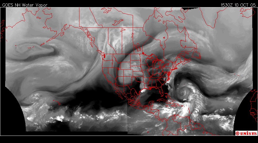
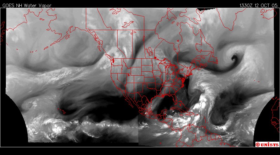
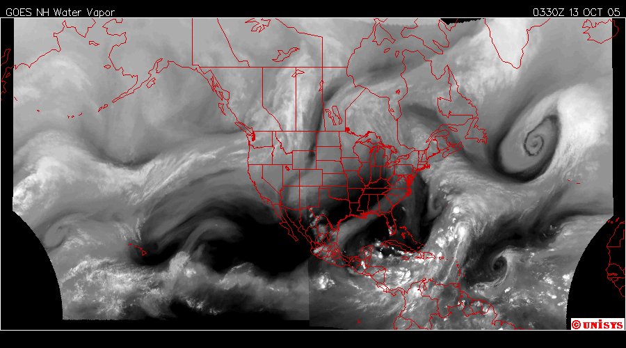
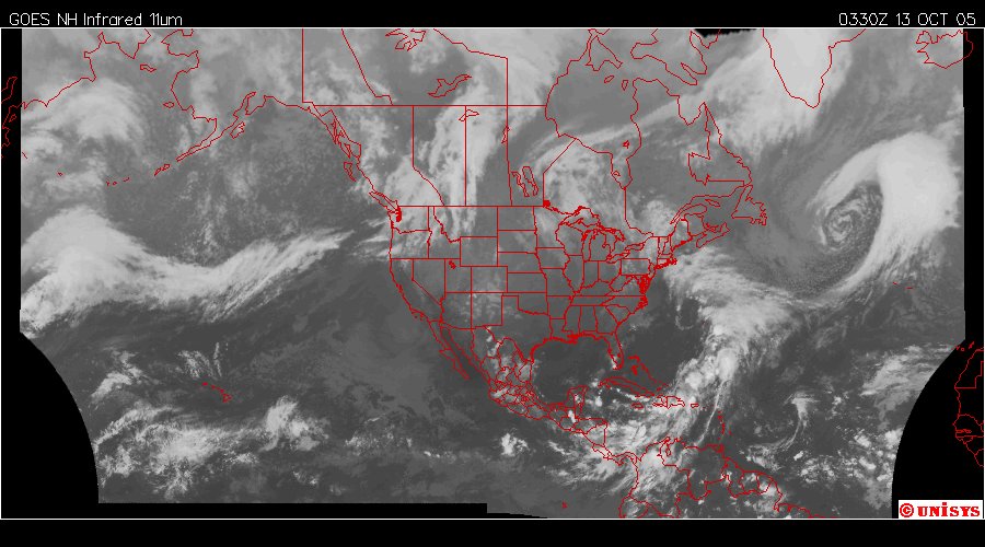
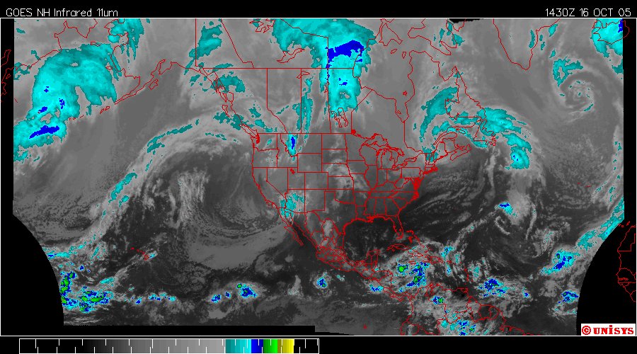
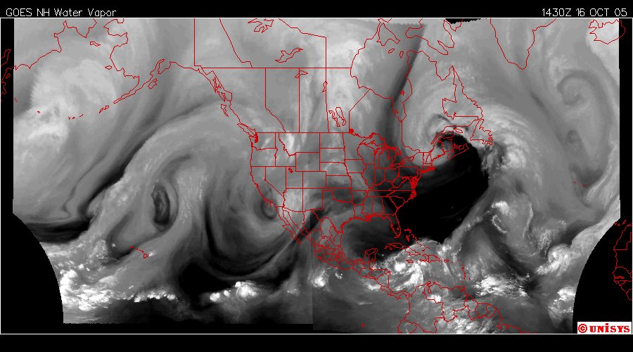
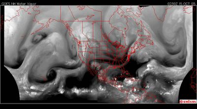
October 15, 2005. 0230 z. This was 36 hours ago when I first noted the heat accumulation in the gulf. At this time there was a serious of vortices working together to move heat from the equator to the Arctic Circle. If one takes a straight edge and places it from the lower left corner to the upper right corner the trend is easily noted. At the extreme was the vortex on the right which went the full length of the upper hemisphere from equator to Arctic Circle, directly over Iceland. The change is do to the change in angle from the sun and where the intensity falls into the troposphere.  Posted by Picasa

October 16, 2005. 1430 z. Enhanced Infrared Satellite. Noted the concentration of 'heat energy' due to Global Warming is noted mostly densely at the Arctic Circle.  Posted by Picasa

October 16, 2005. 1430 z. This is the latest satellite. Tropical Storm Twenty is south of Cuba where is has been since manifesting on Friday evening.  Posted by Picasa

More rain pushes death toll to 11 in Northeastern U.S.

Sun, October 16, 2005

SPRING LAKE, N.J. -- The death toll from a week of driving rain and swelling floods across the Northeast rose to 11 yesterday after a 75-year-old Connecticut man was swept away by rushing water at a campground.


Massachusetts Governor Mitt Romney became the latest governor to declare a state of emergency yesterday after heavy rain and flooding closed roads and forced hundreds to evacuate.

Flood warnings were in effect for New Jersey and New Hampshire, as well as parts New York, Connecticut, Massachusetts and Rhode Island. Some areas have had more than 30 centimetres of rain since Oct. 7. Overflowing lakes and streams forced thousands from their homes in New Jersey and New Hampshire on Friday.

"Well, I don't feel like floating down the river in a mobile home. Just as simple as that," Stan Posner said as he left his home in Keene, N.H.

Many of the 1,300 residents evacuated from Keene returned to their homes yesterday, but a 15-metre mudslide forced part of Route 123 to close. Four people remained missing in New Hampshire from flooding last weekend.

"There's water in the road, water in the basement, literally all over the state," said Jim Van Dongen, spokesperson for the New Hampshire Emergency Management Office.
Flooding made many roads impassable across Connecticut and officials urged those who could to stay home yesterday.


THE PREDICTION SERVICES ARE REFLECTING WHAT I EXPECTED ON FRIDAY EVENING.

The abbreviation "POP" is the 'probability' of percipitation.

Connecticut and Massachusetts