This Blog is created to stress the importance of Peace as an environmental directive. “I never give them hell. I just tell the truth and they think it’s hell.” – Harry Truman
(I receive no compensation from any entry on this blog.)
Monday, November 21, 2005
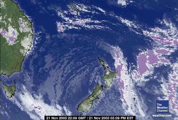
November 21, 2005. 2209 gmt.
West Pacific satellite.
New Zealand is in the southeast corner out of the frame.
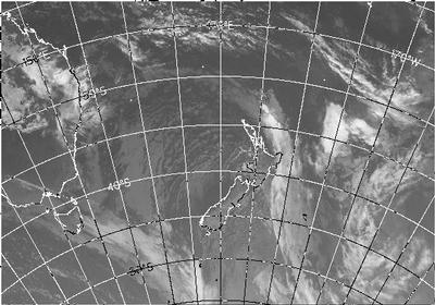
November 21, 2005. 2209 gmt.
New Zealand satellite.
Australia is in the northwest corner of this view.
November 22, 2005. 0600 am.
Time zone not stated. New Zealand Satellite.
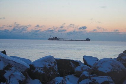
November 21, 2005.
Oamaru, New Zealand.
A very dense front moving into New Zealand today. The 'edge' is clearly visible with the appearance of the edge of a hurricane.
November 21, 2005. 2030z.
Infrared satellite of the north and west hemisphere.
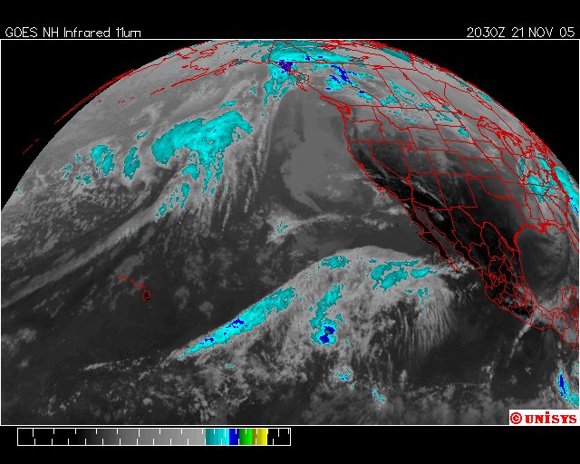
November 21, 2005. 2030z.
Water Vapor GOES West satellite.
November 21, 2005. 2030z.
Enhanced Infrared GOES West Satellite.
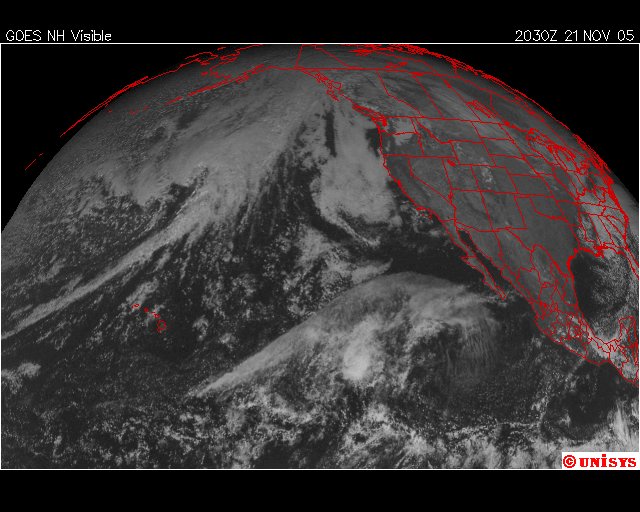
November 21, 2005. 2030z.
Visual satellite of GOES West.
The North Pacific vortex is easily seen in this view.
November 21, 2005. 2000z.
Visual satellite of Alaska.
The North Pacific Vortex is in the lower left corner.
The weather in Antarctica (Crystal Ice Chime) is: Scott Base Cloudy -13.0° Updated Tuesday 22 Nov 8:59AM
The weather at Glacier Bay National Park (Crystal Wind Chime) is:
46 °F / 8 °C Overcast
FLOOD STATEMENT
NATIONAL WEATHER SERVICE JUNEAU AK 600 AM AST MON NOV 21 2005
...THE NATIONAL WEATHER SERVICE HAS ISSUED A SMALL STREAM FLOODADVISORY FOR THE CENTRAL PANHANDLE NORTH OF FREDERICK SOUND ANDTHE CENTRAL COASTAL AREA UNTIL 11 PM AST TONIGHT...
...SMALL STREAM FLOOD ADVISORY REMAINS IN EFFECT FOR THENORTHEAST GULF COAST AND NORTHWEST PANHANDLE UNTIL 11 PM ASTTONIGHT...
HEAVY RAIN WILL FALL OVER THE NORTHWEST AND CENTRAL PARTS OFSOUTHEAST ALASKA TODAY AND THE EARLY PART OF TONIGHT. RAINFALL OF2 TO 5 INCHES IS LIKELY IN THESE AREAS THROUGH THIS EVENING.WATER LEVELS IN SMALL STREAMS AND DRAINAGE DITCHES WILL RAPIDLYRISE AND MAY REACH OR EXCEED THEIR BANKS DURING THIS TIME.RAIN WILL CAUSE CONSIDERABLE PONDING OF WATER IN LOW LYING AREAS,NEAR CULVERTS, AND ALONG SMALL CREEKS AND DRAINAGES.THE NEXT STATEMENT ON THIS EVENT IS SCHEDULED AT NOON AST MON.ADDITIONAL STATEMENTS COULD BE ISSUED AT ANY TIME IF CONDITIONSCHANGE.
EASTERN CHICHAGOF ISLAND-
INCLUDING...HOONAH
7 AM AST MON NOV 21 2005.NOW...
...SMALL STREAM FLOOD ADVISORY IN EFFECT UNTIL 11 PM ASTTONIGHT...
...WIND ADVISORY IN EFFECT UNTIL 11 PM AST TONIGHT...RAIN...HEAVY AT TIMES WITH WINDY CONDITIONS THROUGH THE MORNING.SOUTH WINDS 20 TO 30 MPH GUSTING TO 40 MPH...HIGHER GUSTS INEXPOSED AREAS.
Windchill: 39 °F / 4 °C
Humidity: 76%
Dew Point: 39 °F / 4 °C
Wind: 20 mph / 32 km/h from the SE
Pressure: 29.83 in / 1010 hPa
Visibility: 10.0 miles / 16.1 kilometers
UV: 0 out of 16
Clouds: Overcast 4200 ft / 1280 m (Above Ground Level)
end
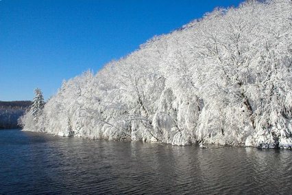
November 18, 2005. East branch of the Escanaba River, Marquette, Michigan.
The water is too warm to freeze.
Consequently, the snow on the rocks melts where the warmer water laps up against the rocks changing the temperature of the side of the rock opposed to the drier top.
There is no ice anywhere. The air is warmer than freezing.
The photographer waited until clouds moved off so the snow covered trees could be seen better.
Here again there is no ice. The snow is dense and pristine white. The flowing river shows no ice flows, chucks of frozen ice in this fresh water river. When one looks for the supporting temperature to a snow storm this dense it looks grossly out of place as if this sound be autumn leaf colors and not white.
This snow storm sustained because of the frigid air mass that carried it to lower latitudes alone. The snow was completely percipitation without a prepared surface to receive it. To me this is an extremely odd picture.
There is ice anywhere, with a very dense and pristine snow everywhere except the warmer and flowing river.
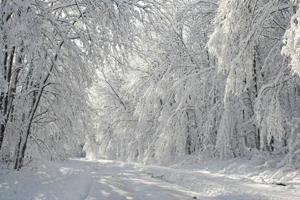
November 18, 2005. West of Marquette, Micigan. It is called the Dead River Area. The name raises lots of anthropological questions.
The photographer stated the temperatures were warm, followed to subzero, returning to warmer temperatures when this snow storm occurred.
My opinion is this is a misplaced storm. It very much looks like a glacial storm. When have you last seen a snow this pristine and pure white? White enough to reflect light back to space?
This is a temperate snow storm intended in days gone by as recharge to northern glaciers. It is dense and pure white. Eventually, before Global Warming vortices cranked up October 2002, this type of snow would eventually become glacial ice. If the temperature returns to freezing this 'temperate' snow might be around for awhile. It is beautiful.