Tuesday, August 22, 2006

A couple possibilities. (Click on to animate)


August 23, 2006.

0230z.

Enhanced Infrared Satellite of the hemisphere.

A lot happened in twenty four hours. There are currently two major storms in the East Pacific. IOKE is a Cat Four. It is near the Hawaiian Islands. It's predicted to go west from it's current position. It has the appearance of a storm with the potential to bend it's path to the northeast as it is a part of a far larger system. It has 'tail' if you will, that leads to the northeast. that is the larger system. I'm going to put a water vapor GOES West image here.

Posted by Picasa

To the left is IOKE. To the right is Ileana. (Click to animate)


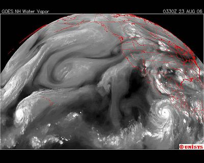
August 23, 2006.

0330z.

Water Vapor GOES West Satellite.

IOKE is in a very odd position in the Pacific. The storms of the Pacific don't start near Hawaii. Hawaii is a land mass. It's warmer than the ocean. No different than the storms that start near Mexico all the time. The aire is hotter there. Hawaii is a volcanic sea chain. It's small in mass. I find it very unusual to have a storm BEGINNING there. It indicates to me the extreme heat of the Northern Hemisphere.

The 'tail' of IOKE extends northeast. This is very similar to a storm that existed in the Atlantic last year. That storm was Wima (click on). As soon as Wilma hit the open water it turned into the vortex it was attached to and head straight into it. I probably have a satellite picture on this blog that illustrates that. Wilma at it's strongest was a Cat 5 with the lowest millibars of central pressure of any Atlantic storm, 802 mbar. Katrina was 902 mbar. Wilma started on October 15 and continued through the 25th, ultimately causing a total of 61 deaths of which 36 were in Florida.

But to get back to the Atlantic storms. Every major storm in the Atlantic is accompanied by one in the Pacific. That is occurring now with Ileana. Currentlly Ileana is moving quickly north but as a rule when there is a major Atlantic storm heading to land, the Pacific storm lingers in a position that seems to support 'the path' of the Atlantic storm. That has been my experience in recent years in observing these stroms.

In realizing that, and that there is more turbulence off Africa resulting in another excalating storm I have to wonder what storm will follow Ileana. Not only that BUT, Ileana is also a part of a larger system noted above .

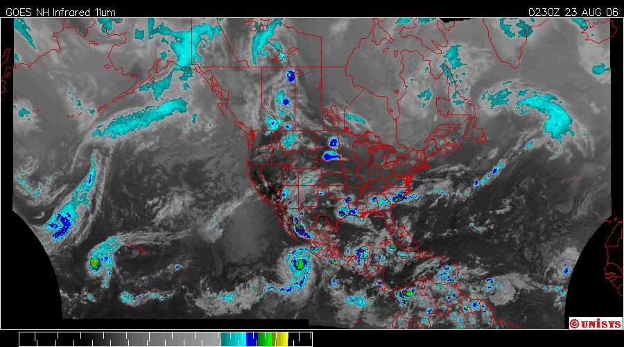
Now, additionally, there has been a lot of turbulence in the Carribean Sea as well.
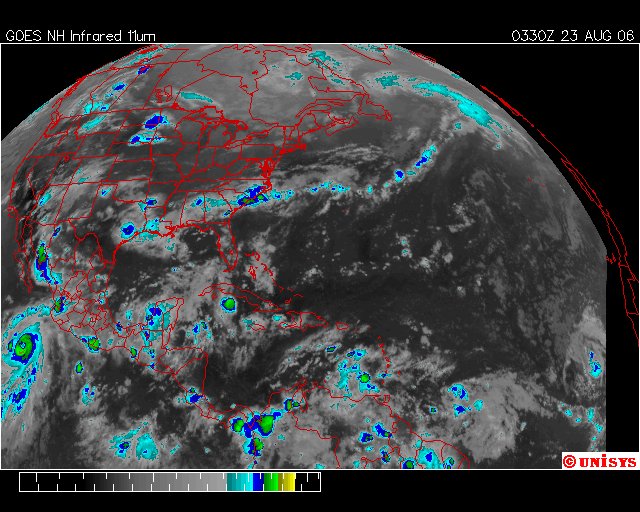
Satellite below.
Posted by Picasa

Click on to animate.


August 23, 2006.

0330z.

Enhanced Infrared GOES East.

Ileana is to the left and the Tropical storm off Africa is to the right. What worries me is the manifestation of a low pressure with rotation on the southwest shoreline of Cuba. It bears watching. It could take on speed as soon as it hits the Gulf of Mexico should it gain velocity and increase to a Tropical Depression. It will probably occur, if it's going to at least by the time the sunlight comes around again increasing the heat just enough to drive it into a higher vorticity. The lesser Antilles has it's questionable exacerbation of the lower angled solar rays of the sun as summer blends into autumn.

Posted by Picasa


August 21, 2006.

Alsemberg, Belgium.

The crops may have done all right without storm damage but it all looks quite saturated to me. If this type of flooding continues there will be crop loss. Very wet soil isn't good for many crops.

Posted by Picasa


August 21, 2006.

The storm that brought so much deluge to Alsemberg, Belgium. Obviously the pictures were taken after the worst of the storm had passed. It was probably quite an event.

Posted by Picasa


August 21, 2006.

Alsemberg, Belgium.

Photographer states :: this is the result of one hour of severe rain in Beersel (10 km of Brussels)


Posted by Picasa

The ocean is slowly claiming Malasiga. They say it's global warming.


This is an illustration of an area of Canada and projected sea level rise by Sierra Club. Just so everyone gets the picture this is a global phenomina. This is not a joke. This is not a 'tree hugger' issue. This is deteriorating coastlines and loss of land, loss of property, storms that kill and all sorts of things.


By Evan Osnos
Tribune foreign correspondent
August 20, 2006


MALASIGA, Papua New Guinea -- First, their fathers noticed the palm trees that seemed to be inching toward the water's edge and the fire pit that vanished beneath the tides.

Later, researchers came, scribbled measurements and offered a grim diagnosis: The sea is coming.

There is not a power line or factory or air conditioner within a day's walk of this village of 400 people in the southwest Pacific, but these subsistence fishermen are no strangers to the power of industrialization and climate change.

"There used to be two rows of houses," said Mickey Tarabi, a wood carver in his 50s, nodding toward the crystal blue sea. "The first one has been moved, and the second one will be gone soon."

Far over the horizon from the most advanced nations, scientists are measuring the effects of global warming in the world's least-industrialized corners. As the World Bank puts it, 15 percent of the world's population lives in high-income countries but releases "more than 75% of the carbon dioxide and other greenhouse gases that are altering the Earth's climate."

If anyone still had doubts, the Bush administration's Climate Change Science Program in May found "clear evidence of human influences on the climate system," echoing the world's leading science organizations on the causes of global warming:

That climate change raises sea levels by heating the oceans, causing them to expand, and by accelerating the melting of glaciers and ice sheets, which funnels fresh water into the seas.
By the middle of this century, smokestacks, tailpipes and other sources are on pace to raise the amount of carbon dioxide in the atmosphere by about 50 percent. In turn, the Intergovernmental Panel on Climate Change predicts that sea levels will rise about 1 1/2 feet, or as much as 3 feet, by century's end.


That doesn't sound like much until you visit a place like this--or Sri Lanka or coastal Louisiana -- where communities are thriving on vulnerable shorelines. In Bangladesh, more than 10 million people live within 3 feet of sea level. Overall, the World Bank predicts that rising sea levels "could displace tens of millions of people living in low-lying areas" around the world.

Worries about the next century

"Sea-level rise isn't going to go away," said John Hunter, an oceanographer who studies sea levels at the University of Tasmania in Australia. "Our main worry is not what has happened in the past 30 or 40 years, but what will happen in the next century."

In a broad new study supported by the Australian government, Hunter and a team of researchers examined decades of measurements of the Pacific and Indian Oceans, concluding that natural fluctuations could not explain the rise. "The analysis clearly indicates that sea level in this region is rising," they wrote.

That is little surprise to Papua New Guinea, a rugged island nation about the size of California, east of Indonesia. The 5.7 million people in PNG, as it is known, have particular interest in their natural surroundings because 85 percent subsist on what they grow, fish or hunt.

Here, rising waters are swamping coastal villages and small islands. Salt water is inundating coastal farms, destroying vital crops and orchards. Among the hardest hit areas are the Carteret Islands, where citizens have tried and failed to hold back rising waters. In April, a minister who visited the area returned to report that islanders were surviving on only coconuts and fish after relief supplies ran out.

`You eventually get drowned'

Professor Hugh Davies of the University of Papua New Guinea calculates that if the estimate holds true, a rise of 50 centimeters to 100 centimeters would be enough to affect all of PNG's coastal plains and swamplands.

"If you are on one of these islands," Hunter said, "you will be continually swamped by water-laden sand, and if you don't clear it up, you eventually get drowned."

PNG has a plan, of sorts. While the country might seem to have little role in reducing carbon emissions--it is better known for forests than factories--its leaders see a way to take part in global efforts to control greenhouse gases.

In international climate talks, PNG and eight other rain forest countries have proposed that nations that reduce deforestation should be eligible to earn and sell "carbon credits." A carbon credit, which represents a ton of carbon absorbed from the atmosphere or prevented from burning, can be traded in international markets under terms set by the Kyoto Protocol--meaning, in theory, a farmer could make more money from saving his forest than razing it. Current rules allow countries to earn credits for planting new trees but not for protecting existing ones.

"You want us to go down the path to sustainable forest management. Now give us the right incentive to do this," said Gunther Joku, a senior policy planner at PNG's Department of Environment and Conservation.

Whatever happens, it will probably be too late for Malasiga. The village sits on a small, flat peninsula jutting into the Solomon Sea. Drying turtle shells dangle in the wind, and children shinny up palm trees for coconuts.

Some villagers have fled for higher ground, but most have not. They seem to know that when the history of the village is finally written, nobody will say they weren't warned. Yet they struggle to recognize the problems before them.

"I grew up here," said Aaron Mokedu, who is preparing to move the single-room thatched-roof home he shares with his wife and two sons. "But now the water comes up too far. It's not like before."

Elders first noticed the rising water in 1982. It eroded the sand and bared the rocks beneath. Then it tugged down the palm trees beside the ocean's edge. Eventually it began lapping at the stilts that hold up their thin-walled homes. About five years ago, the highest tides swamped the village entirely for the first time anyone could recall.

Holding back rising seas

A world away, other places are trying to hold back rising seas as well. A Dutch developer is selling "amphibious homes" built on pontoons. The German island of Sylt is reportedly coating its rocky shores with a polyurethane that it hopes will dampen erosion caused by waves and hurricanes.

Here in Malasiga, they have a slightly lower-tech strategy: reclaiming land on the leeward side of the peninsula, one handful of dirt at a time.

"When we sweep up, we put all the leaves and coconut shells and sand over here," Tarabi, the wood carver, said, studying the fragile brown sliver of land they had filled in behind their homes. He shrugged.

"In 1997, some graduate students came and told us this was going to happen," he said, "And now it has happened."

Posted by Picasa

Desert Fires' Damage Will Last


August 21, 2006.

The government is using some kind of new classification system they don't bother to explain in the map key, but, who ever said the public should know what is going on with their government.

At any rate there are currently 55 wild fires of which six or so are controlled burns. Those that are controlled burns appear to be 'back fires' set in response to out of control destruction of forests due to drought.


It will take centuries for plant life to recover. Many experts say invasive vegetation is largely to blame.

By Janet Wilson
Times Staff Writer
August 21, 2006


April Sall stood in the charred remnants of a Joshua tree forest, bark peeling off melted black limbs. Above her, ridges once thick with 1,000-year-old piñon and juniper pines were scorched bedrock and stumps.

More than 90% of the surrounding Pipes Canyon Preserve was consumed in last month's Sawtooth blaze. It was one of half a dozen fast-moving fires this summer that burned 65,000 acres of the Mojave Desert, fueling debate over whether the desert is burning more frequently and explosively as a result of invasive weeds, smog, development and climate change.
"It's heartbreaking to see," said Sall, a biologist who manages the preserve and whose grandmother homesteaded the land a century ago. "We'll never see those piñon or juniper trees again in our lifetimes, nor will our children, nor will their grandchildren. It's a bitter pill…. This land isn't meant to burn."


Many scientists agree, saying the recent blazes offer fresh evidence that deserts across the Southwest are undergoing a profound shift, as ancient native pine, shrubs and cactuses give way to young, highly flammable weeds and grasses.

"Right now we're losing very large pieces of landscape," said Todd Esque, an ecologist with the U.S. Geological Survey in Henderson, Nev., who studies the cause and effect of fires in the desert. "It's happening in Joshua Tree National Park, it's happening in Mojave National Preserve … up in southwestern Utah … and in Arizona. We lost 750,000 acres of desert to fire in Nevada alone last summer."

This summer, five blazes have seared parts of Joshua Tree, where a fire only every few years was the norm for the last 50 years.

Esque and other researchers say that unlike forests and chaparral, the sparsely vegetated desert is not meant to burn frequently.

"The public has come to understand that fire is a necessary part of the life of forests," Esque said. "That is not the case with deserts. We have a major problem going on."

A vocal minority disagrees, contending there is no clear-cut evidence of far-reaching change. They blame this year's fires on bumper crops of wildflowers nourished by heavy spring rains two years ago. According to the theory, dried remnants of the prolific blooms fueled a 50,000-acre fire in the Mojave National Preserve last summer and in this year's conflagrations.
"The winter of 2004-05 was the wettest ever in 100 years of recorded data in the desert. We had a phenomenal crop of annual native wildflowers, and it was dry the next year and it stayed there," said Richard Minnich, a professor of Earth sciences at UC Riverside. "It's flash fuel of 1 to 2 tons per acre. What's really scary is, there's still a lot of it out there."


Scientists do agree that it will take centuries, if not millenniums, for the desert to recover.
"It won't be on a timeline we humans would like, but it will happen," said Tasha LaDoux, Joshua Tree National Park's botanist.


Inside the park, new growth provides fodder for the debate over whether the fragile, arid landscape is undergoing dramatic change.

At the scene of a 1995 fire, not a single juniper or piñon pine seedling has come up after 11 years. But healthy, 3-foot "pups" have sprouted from the roots of once seemingly dead Joshua trees. The pups may or may not survive, scientists say, because in drought years they may be gnawed by thirsty rodents and ground squirrels. Meanwhile, native apricot mallow, bright-green cheesebush and golden California marigold are blooming even in August.

Along a sandy road in the western section, the scene of a 1999 blaze that scorched 14,000 acres, a beige sea of grasses spreads beneath burned Joshua trees bleached silver by sun and rain. The new growth consists of native bunch grasses and a pair of noxious, ankle-scratching weeds.
These two nonnatives, known as red brome and cheatgrass, form highly flammable carpets between native shrubs and trees, and many scientists believe they are the main culprits behind increasing fires.


"These invasive grasses fill in the spaces between the desert plants. They carry the flame through at a very high rate, and much hotter. It spreads a lot faster," Sall said.
The weeds are also bad for animals.


"The ranchers call it cheatgrass because for the first few years it's good grass, but after that it cheats the cattle of their nutrients," Esque said.

Native to Mediterranean Europe and Asia, the weeds were probably blown across the West by the wind, tracked in by hikers' boots and construction equipment, and excreted by livestock. Researchers at UCLA and elsewhere say the weeds appear to capture nitrogen from smog-laden air more readily than native plants, eventually choking them out.

But Minnich of UC Riverside said years of drought had actually caused most of the red brome to die out, while annual native grasses remain safely stored in natural seed banks on adjoining, unburned islands of habitat.

Richard Halsey couldn't disagree more.

"You're going to see a solid blanket of yellow felt next year," he said, meaning a blanket of dried nonnative grasses. Halsey, a former biology teacher who is now a researcher and firefighter, was asked by the U.S. Bureau of Land Management to evaluate the role of vegetation in the Sawtooth fire.

"No one else on the planet agrees with Rich Minnich," Halsey said. "I went out there during the fire and after the fire and looked…. Not only didn't I see the volumes of wildflowers he's talking about, but in the burn area specifically…. I had a hard time finding natives. The predominant fire fuel mix was cheatgrass and red brome."

Robert Webb, a hydrologist with the Geological Survey's Tucson office who has studied botany in the Mojave for 30 years, laughed when he heard about the debate.

"The truth is, they may all be right. The desert is very complicated. There is incredible local variability," he said. Echoing other scientists, he said, "Minnich often heaves these ideas out there that are different…. It's healthy, it makes us all look very carefully at our own data."
Webb is writing a paper with other researchers that looks at three post-fire scenarios for the Mojave, all plausible, all different. Rather than focusing on Joshua trees or pines, they studied ancient black brush, a gray-brown shrub that has evolved to withstand desert temperatures and scarce rain.


A single bush can survive thousands of years. But it is highly flammable, proof to Webb that fire is not natural in the desert. One scenario does show nonnatives replacing black brush and causing more frequent fires. But he said data gathered so far made that scenario "only slightly more likely" than two others in which black brush grows back.

"Some of those Joshua trees may sprout too," Wall said, referring to the Pipes Canyon Preserve. "They're an amazing tree."

But others say such a destructive fire in a preserve like Pipes Canyon did lasting harm.
Tom Scott, a zoologist affiliated with UC Berkeley and UC Riverside, said the canyon preserve encompassed "one of the greatest transition zones in North America. If you look at where it starts way up on top of the San Bernardino Mountains, and then descends down to the desert, you're covering this incredible array of habitats, from montane forest down to low desert."
Scott said there were probably smaller pockets of plants and animals that evolved over millenniums in nooks in the preserve, only to be wiped out by this summer's catastrophic fire.
"If we've introduced grasses that are driving fire much further than it used to go, and you've got a lot of these small patches that are really unique in terms of species, then you're erasing them with large conflagrations," he said.


Esque worries about vulnerable desert species such as the reclusive desert tortoise, Scott's oriole, logger-headed shrike and least Bell's vireo songbirds, as mature shrubs that offered shelter are replaced with grasses.

"When you have less cover, with that goes less diversity," he said.

Webb is most concerned about warming temperatures in the desert. Besides causing less winter snow, warmer weather generates more summer thunderstorms and lightning strikes. Lightning started all the fires that ravaged Pipes Canyon Preserve and Joshua Tree National Park this summer.

Others said urbanization, motorized recreation and military activities were also taking a toll on the natural desert.

"What will be the one thing that does in the desert as we know it? It's not one thing. It's the onslaught of all these things," Esque said. He said there was little that could be done to turn back the clock. Many nonnative weeds are too far spread to be dug out, while native seeds are not widely available and can cost millions of dollars to gather and plant.

Beyond planting a bit of native seed, Sall said, she plans to let Pipes Canyon come back on its own, however long it takes.

Greg Hill of the Bureau of Land Management's Palm Springs office said his agency will take a similar approach to other burned areas in the desert.

"We'll let it regenerate naturally," he said. "It's the largest big chunk of undeveloped land left in Southern California."


Joshua Tree park might lose trees Eco-group says global warming killing species
Chuck Mueller, Staff Writer


JOSHUA TREE NATIONAL PARK - Global warming and air pollution are threatening to take Joshua trees right out of this national park, according to a national conservation group.

"Joshua trees require a cooler habitat," said Deborah DeMeo, California desert field representative for the nonpartisan National Parks Conservation Association.

"With global warming, the trees wouldn't survive and their habitat will shift northward," she said. "Since they propagate slowly, they won't be able to adapt.

"Within this century, global warming could eliminate more than 90 percent of the park's Joshua trees, leading to the park being overrun by invasive grasses and weeds."

Carbon-dioxide emissions from vehicles and trains contribute significantly to global warming and climate changes, according to the conservation group.

The group warns that the trees could disappear from the park in eastern San Bernardino County due to high levels of carbon-dioxide emissions and ozone levels.

"The impact of global warming and air pollution are inter-related," DeMeo said.

Joshua Tree National Park experiences the highest ozone pollution level of any of America's national parks, according to "Turning Point," a report issued earlier this month by the conservation group.

"For the first time at any of the national parks in the California desert, Joshua Tree has installed warning signs to alert the public about the health hazards from the park's poor air quality," DeMeo said.

The 794,000-acre national park attracts more than 1.2 million visitors each year.

Neither Death Valley National Park nor the Mojave National Preserve are considered at risk from air pollution, DeMeo said.

"But at Joshua Tree, park officials have installed signs at three of the park's entrances to alert visitors about the severity of health threats from poor air quality," she said.

Paul DePrey, Joshua Tree National Park's chief of resources, said a strategy to deal with the threat to the park's signature tree must be developed within 10 years to reverse that threat.

According to park naturalist Joe Zakki, the U.S. Geological Survey has launched studies into the threat of climatic change on Joshua trees and is working with the National Park Service to evaluate the impact of air pollution on the plants.

"When all the data is gathered, we'll know if young Joshua trees are replacing themselves," he said.
Joshua Tree National Park exceeds unhealthful air-quality standards at various times of the year, especially in the summer. Prevailing wind patterns lift polluted air passing through the San Gorgonio Pass into the national park.

"From Keys View at the south edge of the park, visitors can look down and see brown air streaming through," Zakki said. "The pristine air that many people expect in the park isn't always there."

Data collected at the Black Rock monitoring station near Yucca Valley shows that ozone levels exceed health standards and are among the worst in the national park system, the naturalist said. Two desert ecosystems converge in Joshua Tree National Park, according to "Turning Point."

"Global climate change is endangering the park's biodiversity, and especially the flagship species for which it is named," the report says.

The conservation association recommends 10 steps to clean the air in the national parks. These include cleaning up outdated power plants, requiring new power plants to use the lowest polluting technologies and enacting stronger power plant mercury controls.

"Also, we must ensure that legal limits on park air pollution are not exceeded, and measures are taken to promote clean, renewable domestic energy supplies," DeMeo said.


Posted by Picasa

August 18, 2006. Upton, Wyoming. The Four Mile Fire. Posted by Picasa


August 18, 2006.

Upton, Wyoming.

Posted by Picasa


August 18, 2006.

Upton Wyoming.

Photographer states :: This fire was called the 4 Mile Fire. It was a timber fire near Newcastle, Wyoming. I was fighting it Friday and Saturday of this week.

Posted by Picasa

We are STILL frozen. (Click to Animate)


August 18, 2006.

12:00 PM.

Antarctica.

There is an occassional temperature that is inching closer to above freezing but considering we are leaving the days of winter it's not a complete surprise, but, still leaving a very short ICE season. HOWEVER, it was longer than last year. There were no freezing temperatures on the Peninsula at all last year.

The temperatures this week.

Posted by Picasa
The weather in Antarctica (Crystal Ice Chime) is:

Scott Base

Snow

-26.0°

Updated Tuesday 22 Aug 8:15AM

The weather at Glacier Bay National Park (Crystal Wind Chime) is:

57 °F / 14 °C
Overcast

Humidity:
72%

Dew Point:
48 °F / 9 °C

Wind:
6 mph / 9 km/h from the WSW

Pressure:
30.03 in / 1017 hPa

Visibility:
10.0 miles / 16.1 kilometers

UV:
1 out of 16

Clouds:
Scattered Clouds 1200 ft / 365 m
Mostly Cloudy 1700 ft / 518 m
Overcast 3000 ft / 914 m
(Above Ground Level)


end