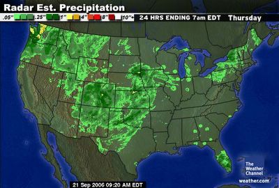
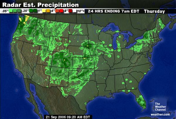
 September 21, 2006. 0920 gmt. Percipitation satellite.

The Rogers MN Tornado
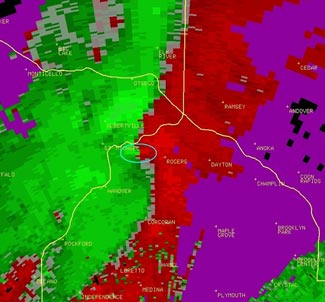
The Rogers, MN tornado Saturday night appears to have been essentially of the latter type. The National Weather Service has made information on the event available on-line. Radar shows a linear thunderstorm pattern prior to the tornado, with a velocity pattern that was indicative of a sharp shift of winds along its whole leading edge. That shear zone quickly broke down into a pocket of rotation just as the storm neared Rogers. That circulation signature shows up as adjacent pockets of red and green circled on the figure below.As a consequence, the NWS had issued a severe thunderstorm warning for the area based upon the linear configuration, then issued a tornado warning for Anoka County once the low-level rotation signature developed. Unfortunately, that was too late for Rogers.
September 21, 2006
SEPTEMBER TORNADOES
Dr. Greg Forbes, Severe Weather Expert
September is not normally a very active month for tornadoes unless there are landfalling hurricanes and tropical storms. But an F2 tornado struck Rogers in the northwest suburbs of Minneapolis late Saturday evening, killing a ten-year-old girl. As you may have heard, the tornado Saturday night struck Rogers without a tornado warning.
Over the past 10 years, September has averaged 95 tornadoes. Almost exactly half of them have been spawned from remnants of tropical storms and hurricanes. During that period there have been 16 tornado deaths in September in the United States, all but four of them associated with the remnants of tropical systems.
September is late in the tornado season for Minnesota. Most occur from late April through July. In the Twin Cities metro, there has just been one later tornado since 1950, just a year ago on September 21, 2005. Severe thunderstorms that day caused extensive damage in Rogers and nearby areas of Hennepin and Anoka Counties. Saturday's tornado caused just the fourth September death in Minnesota since 1950, out of a total of 93 total tornado fatalities.
Many tornadoes develop from supercell thunderstorms in which there is initially a strong rotation aloft at mid-levels of the storm, descending to ground or developing at low-levels subsequently. The tornado potential of these storms is readily detectable by Doppler radar and usually allows tornado warnings with lead times of about 10 minutes or more. The average lead time for tornado warnings is about 13.5 minutes.
Some tornadoes, however, develop from a low-level circulation, often in a region where winds at the surface shift direction sharply, without any appreciable rotation initially aloft. These are often called non-supercell tornadoes and are problematic from a warning perspective. The circulation develops fast, often in between the 5-minute scan times of the National Weather Service Doppler radars. Nationally, about 28% of tornadoes strike prior to the initial tornado warning.
The Rogers, MN tornado Saturday night appears to have been essentially of the latter type. The National Weather Service has made information on the event available on-line. Radar shows a linear thunderstorm pattern prior to the tornado, with a velocity pattern that was indicative of a sharp shift of winds along its whole leading edge. That shear zone quickly broke down into a pocket of rotation just as the storm neared Rogers. That circulation signature shows up as adjacent pockets of red and green circled on the figure below.
As a consequence, the NWS had issued a severe thunderstorm warning for the area based upon the linear configuration, then issued a tornado warning for Anoka County once the low-level rotation signature developed. Unfortunately, that was too late for Rogers.
Because of the speed with which some tornadoes can develop from initially linear low-level wind shear patterns, it may not be possible to give tornado warnings with adequate lead times for every tornado. A future generation of radar now being considered by the National Weather Service may be able to scan at 1-minute intervals, allowing detection of the developing low-level circulation a few minutes earlier than with the present radars.
http://www.weather.com/blog/weather/8_10634.html?from=wxcenter_news
Weather Forecast: Severe weather possible today
Story by Craig Gold (Contact)
Originally published 09:08 a.m., September 21, 2006
Updated 09:16 a.m., September 21, 2006
A very potent area of low pressure is sliding across the Sunflower State and could trigger thunderstorms, some severe, during the course of Thursday.
It looks like instability is limited due to a lack of rich moisture from the Gulf of Mexico, and a lack of sunshine. But, the storm system is so dynamically driven that it might have enough punch to give Northeast Kansas a few afternoon storms with damaging wind and hail. Expect highs to be right around 70 and winds rather gusty from the south at 20 to 30-plus mph.
Storms should linger into the overnight and end towards Friday morning with lows in the upper 50s. On Friday, the area will see a mixture of sun and clouds before another impulse comes our way. Expect more showers and storms towards the evening.
These showers could stick around through the first half of Saturday, which is the first full day of fall, with highs around 70, but expect the sun to return by Sunday.
The beginning of next week looks to be dry and pleasant with highs in the middle 70s.
http://www.49abcnews.com/news/2006/sep/21/severe_weather_possible_today/
Stormy weather in Oklahoma's forecast
A tornado watch was in effect for more than half the state late Thursday as a strong low pressure system blew into Oklahoma, bringing a chance of showers and thunderstorms for Friday.
The National Weather Service issued tornado watches that expired at midnight for south central and southeastern Oklahoma. Tornado watches for north central and northeastern Oklahoma expired Thursday evening.
Forecasters said the low pressure system tracked across Kansas Thursday afternoon and created strong south to southwest winds across much of Oklahoma and northern Texas. Wind advisories were issued for 30 Oklahoma counties as winds between 25 mph and 40 mph and gusts up to 50 mph affected the state.
With southerly winds, warm and humid air will move into the state Friday increasing the chance for showers and thunderstorms in eastern Oklahoma. Thunderstorms could become severe toward the afternoon and evening.
A cold front associated with a second upper level low will make its way into Oklahoma by Saturday, creating new chances of showers and thunderstorms Saturday and Saturday night.
Cooler and drier weather will return to the state on Sunday.
Friday will be breezy and partly cloudy with a chance of showers and thunderstorms in eastern and central Oklahoma. Highs will range from the mid 70s in the Oklahoma Panhandle to around 90 in eastern Oklahoma.
More showers are possible in eastern Oklahoma Friday night with a slight chance in the far western Panhandle. Lows will range from the mid 40s in the Panhandle to around 70 in far southeastern Oklahoma.
Saturday will be partly cloudy in western Oklahoma to mostly cloudy in the east. Showers and thunderstorms are possible in eastern Oklahoma. Highs will be in the 70s with lows mostly in the 50s.
Skies will be partly cloudy on Sunday with a chance of showers and thunderstorms in far southeastern Oklahoma. Highs will be in the 70s. Lows will range from the mid 40s in the Oklahoma Panhandle to around 60 in far southeastern Oklahoma.
Monday and Tuesday will be mostly clear and dry with highs in the 70s and 80s and lows in the 40s and 50s.
http://www.kristv.com/Global/story.asp?S=5442616&nav=Bsmh
Severe weather possible as storm system approaches
OKLAHOMA CITY The National Weather Service has issued a tornado watch for 28 counties in western Oklahoma.
The watch stretches along and 70 miles east and west of a line from 20 miles northwest of Salina, Kansas to 60 miles south-southeast of Childress, Texas.
In Oklahoma, the watch area stretches from Beaver County in the Panhandle eastward to Noble County, then southwestward to Grady County and westward to Harmon County.
Forecasters say storm chances are being enhanced by the expected collision of a powerful storm system with hot temperatures, abundant tropical moisture and strong south winds.
The severe weather threat was forecast to linger into tomorrow and diminish by mid-day on Monday.
http://www.kten.com/Global/story.asp?S=5418025
Tornado Watch In Effect For North Central Texas
(September 21, 2006)—No storms showed up on radar anywhere in Texas early Thursday afternoon, but National Weather Service forecasters say conditions are shaping up for a “potentially significant severe weather event” late in the afternoon and into the evening just to the north of the immediate Central Texas area.
A tornado watch is in effect for North Central Texas until midnight Thursday that includes Ellis and Johnson counties.
Tornadoes, hail up to 2 inches in diameter, thunderstorm wind gusts of up to 80 miles an hour and dangerous lightning are possible in the watch area, which is along and 125 miles east and west of a line from northeast of Durant, Okla. to 50 miles southeast of Dallas.
http://www.kwtx.com/breakingnews/4200946.html
Tornado Causes Damage In Russell (Video)
Russell
Deb Farris
Tornado Touches Down In RussellSeptember 21--A tornado touched down in Russell early this afternoon, causing damage on the west side of the city.
The twister was reported around 2 p.m. It damaged three industrial buildings. There are no reports of injuries.
Russell County's Sheriff says the tornado was on the ground for a short time. One building was destroyed, and two others were seriously damaged by debris.
http://www.kake.com/news/headlines/4203126.html
Isolated storms possible tonight, tornado chance Friday, forecast says
Ryan Slight
© 2006, Springfield News-Leader
Springfield-area residents could experience a few isolated severe storms tonight, and possible tornadoes tomorrow.
The National Weather Service said thunderstorms capable of producing winds of up to 60 miles per hour and nickel-sized hail may develop later.
Locations along and west of U.S. Highway 65 may be affected after 10 p.m., the service said.
Additional thunderstorms developing tomorrow afternoon and evening could produce large hail and ?a tornado or two,? the service said.
Heavy rainfall resulting in localized flash flooding is also possible tomorrow, the service said.
http://www.news-leader.com/apps/pbcs.dll/article?AID=/20060921/BREAKING01/60921002
 September 22, 2006. 0123 gmt. North Pole Satellite.The supercell is at 6 o'clock on the face of a clock. Storm Helene is at 5 o'clock. It is a Cat 3 storm with a central pressure of 954 millibars. Typhoon YAGI is at 10 o'clock. It is a Cat 5 storm.That is one sparcely clouded hemisphere. I don't what kind of shape the Arctic Ocean is in but it isn't sharing much moisture with the rest of Earth. Holy smokes, what a mess.
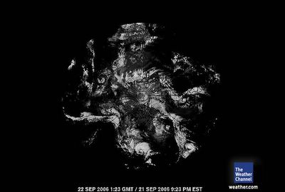
 September 22, 2006 0123 gmt. South Pole Satellite.
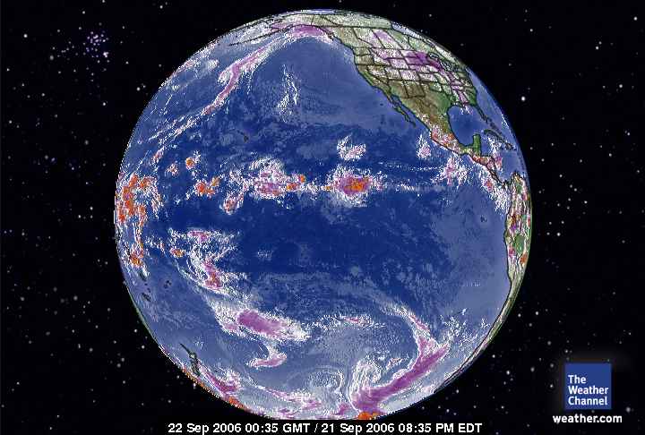
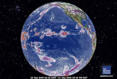 September 22, 2006. 0035 gmt. Pacific Global Satellite.
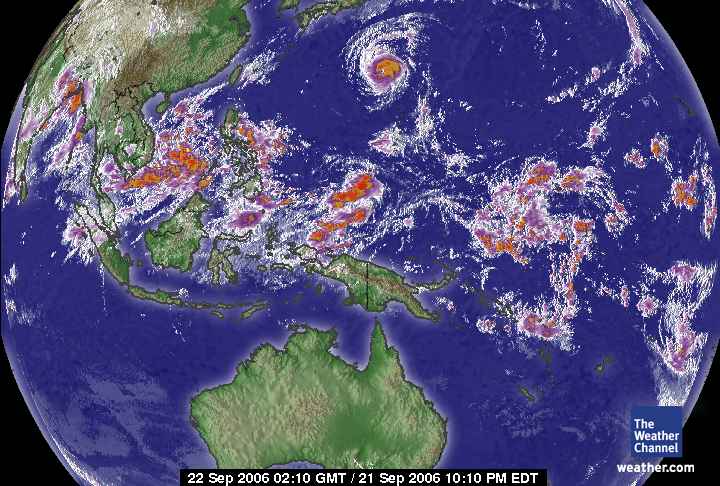
 September 22, 2006. 0210 gmt. West Pacific Global Satellite.
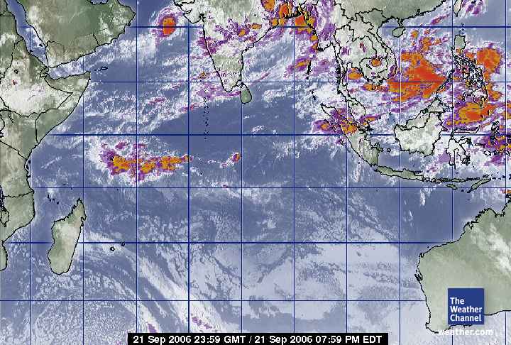
 September 21, 2006. 2359 gmt. Indian Ocean Satellite.
 September 22, 2006. 0027 gmt. Africa - Europe Satellite.
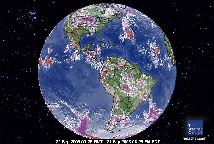
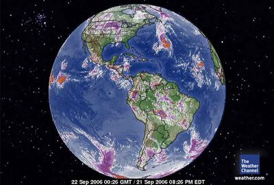 September 22, 2006. 0026 gmt. Western Hemisphere.
 September 22, 2006. 0017 gmt. Atlantic Ocean Satellite.
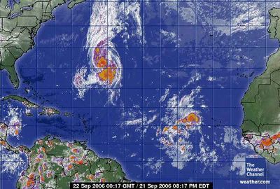
 September 22, 2006. 0017 gmt. Tropical Atlantic Satellite.
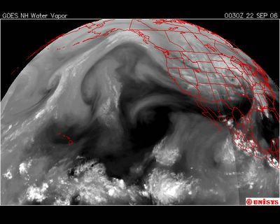 September 22, 2006. 0030z. Water Vapor Satellite GOES West.
 September 21, 2006. 0923 edt. North America from Canadian Satellite.
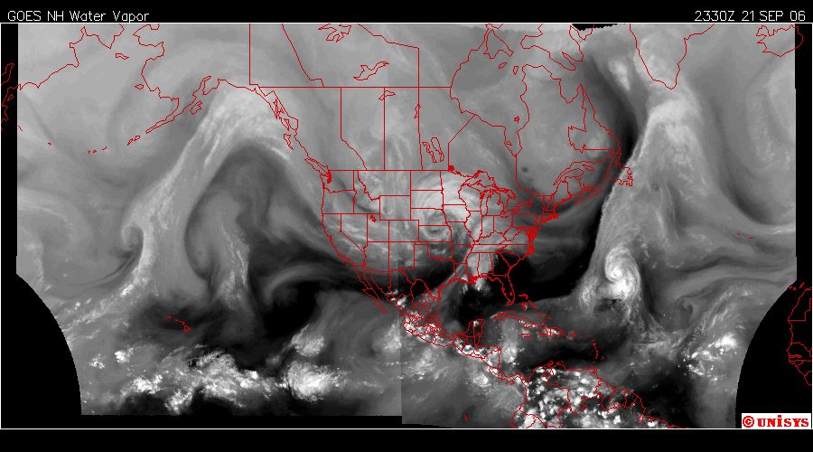
 September 21, 2006. 2330z. Water Vapor Satellite of West and North Hemisphere.
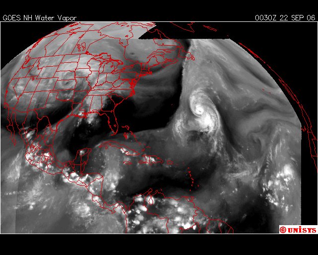
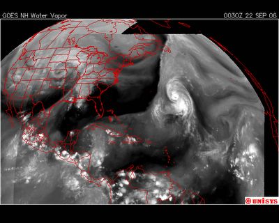 September 22, 2006. 0030z. Water Vapor Satellite GOES East.
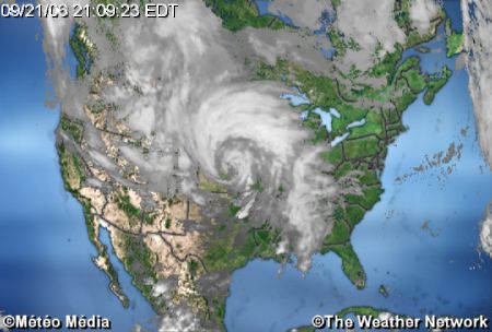
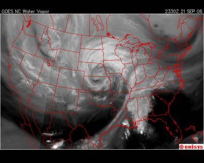 September 21, 2006. Water Vapor Satellite of the USA.That is what I call a Supercell.
 World Peace Day - This is the 2005 emblem. I thought it was a beautiful symbol and appropriate for this blog. Black Hills Wopila is an American Indian Reservation (Click on)


