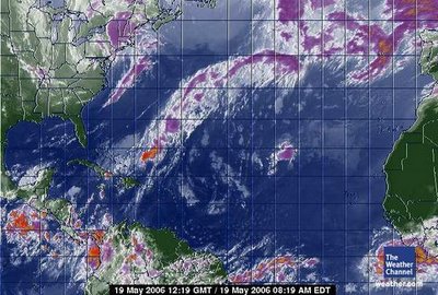
 May 19, 2006. 1219 gmt. Tropical Atlantic Satellite.
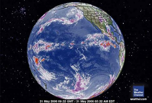
 May 31, 2006. 0932 gmt The Pacific Global Satellite."Heat" storm noted in context to Antarctica and South America in this view. It is in the very western aspect of the Pacific. Huge ocean, isn't it? Other than that the boundaries between the Antarctica vortex and the equator is pretty healthy. Look at that monster vortex of the Northern Hemisphere. Lots of terra firma. Lots of heat in the Nothernn Hemisphere. Different dynamics.
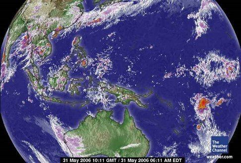
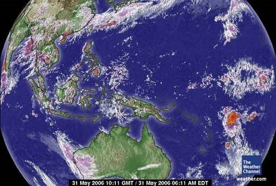 May 31, 2006. 1011 gmt. The Western Pacific Satellite.The 'heat;' off the east coast of Australia is lending a hand to concentrating any remaining heat in the Southern Hemisphere and it is being depositied in Antarctica.
The Barometic Pressure is falling so they are do some percipitation. That does include snow with temperatures above freezing.Updated: 1 hr 47 min 24 sec ago
Observed at:
Base Orcadas, AntarcticaElevation:
20 ft / 6 m 37 °F / 3 °C ClearHumidity:
79%Dew Point:
33 °F / 0 °C Wind:
12 mph / 18 km/h from the North
Wind Gust:
- Pressure:
29.97 in / 1015 hPa (Falling) Visibility:
12.0 miles / 20.0 kilometers UV:
0 out of 16
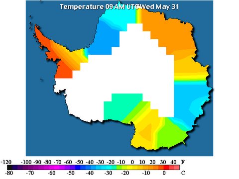 Click on above link to animate. There is a heating again of the Peninsula minimally. I kinda expected this. It's a known rule of thumb with Global Warming that if there is a severe cooling trend there has to be a heat build up somewhere that will eventually manifest in a reheating of the colder surface. WAIS. The West Antarctica Ice Sheet. The Weddell and Ross Seas (click on) are always the target of the heat from the continent of South America.The '-30s' was just a little too cold to be true. I can dream can't I? The penguins enjoyed a holiday for a couple of weeks for a change. Now, I am sure they are more confused than ever.
We are approaching more 'usual' temperatures in Antarctica. There has to be a warming trend.
The weather in Antarctica (Crystal Ice Chime) is:
Scott Base
-18.0°
Updated Wednesday 31 May 8:00PM
The weather at Glacier Bay National Park (Crystal Wind Chime) is:
48 °F / 9 °C
Overcast
Humidity:
82%
Dew Point:
43 °F / 6 °C
Wind:
4 mph / 6 km/h from the NW
Pressure:
30.11 in / 1020 hPa
Windchill:
47 °F / 8 °C
Visibility:
10.0 miles / 16.1 kilometers
UV:
0 out of 16
Clouds:
Overcast 6500 ft / 1981 m
(Above Ground Level)
end
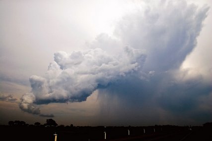
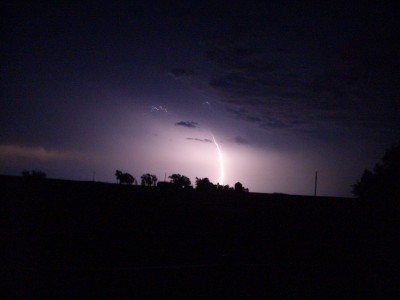 May 29, 2006. Buffalo, Okalhoma.Photographer states :: We were treated to a lot of lightning tonight, unfortunately the rain was East of us again.To illustrate the elusiveness of the 'rain' and the dominance of the lower troposphere it is noted this photographer is suffering in drought from rain. The 'intensity' of the storm is under the 'path' of the vortex. The dominance of the trospheric aire masse is still the controlling factor of the CLIMATE of Earth. The vortices are a manifestation of 'heat relief' of the lower troposphere that has resilience against 'incorporating' the heat rather than shunting it out of it's biotic layer. The Human Induced Global Warming is COMPLETELY reversible. As a matter of fact, Earth's trophosphere demands it !
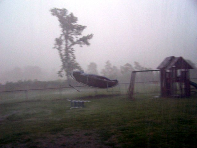
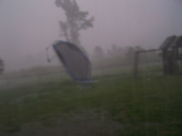
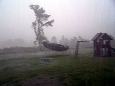 May 29, 2006. Senatobia, Mississippi. This picture is enhanced for easier viewing. Photographer states :: High winds carried off our my sisters trampoline.I did not have time to focus.The photographer in referring to 'focus' is referring to the camera lens. The 'focus' of the photographer is more correct than any satellite orbiting Earth.
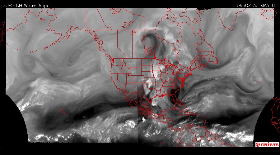
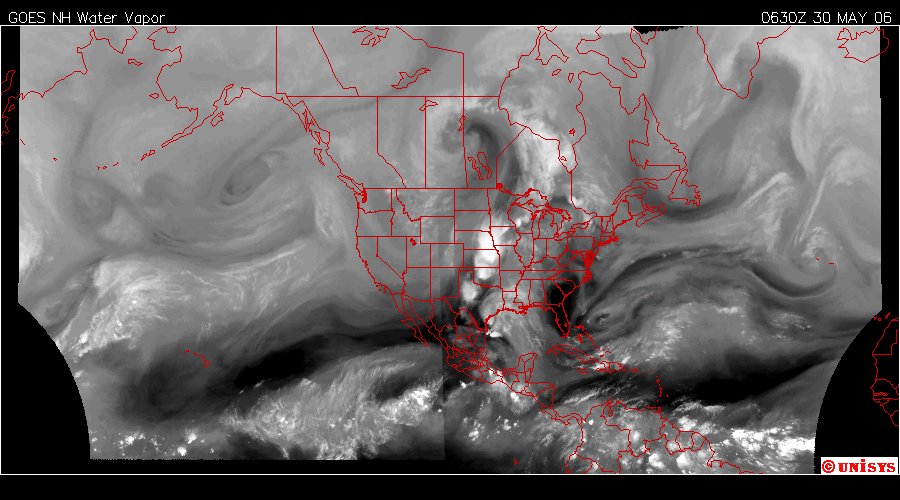
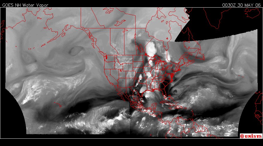
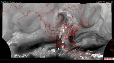 May 30, 2006. 0930z. Current water vapor satellite from UNISYS. Click on above link for 12 hour loop. Thank you UNISYS.The vortex is at higher altitudes from the other air movement. The underlying air movement is primarily the same from west to east. The 'vortices' culminate at much higher altitudes nearing the lower stratosphere and 'ionically charged' by elemental carbon and oxygen at the interface of the stratosphere and troposphere. Over the years since the manifestation of the first vortex of October 4, 2002 the intermingling of gases has become nearly a 'layer' of air all by itself where these monsters call home.
 May 29, 2006. Senatobia, Mississippi.Photographer states :: Bye, bye trampoline. High winds carried off our my sisters trampoline.
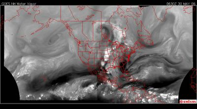 May 30, 2006. 0630z.UNISYS Water Vapor Satellite of the North and West Hemisphere. The vortex appears as a huge question mark in the middle of the North American Continent.
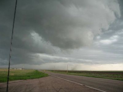 May 28, 2006.Lusk, Wyoming.It's on the ground. There isn't a big debris field yet. The 'reach' of this tornado extends all the way to the horizon. Follow the cloud bank behind it.
 May 30, 2006. 0330z. The vortex is forming. This was six hours ago. The center is north of the Canadian border. That is a 'direct' result of a very hot Gulf of Mexico.
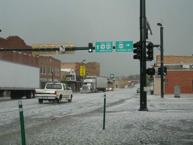
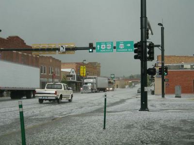 May 28, 2006. Lusk, Wyoming Hail Storm. Photographer states :: Temperature dropped from 80 deg F to 34 deg F, 2
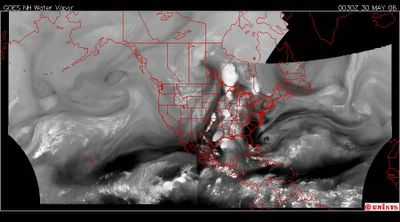 May 30, 2006. 0030z. Nine hours ago.
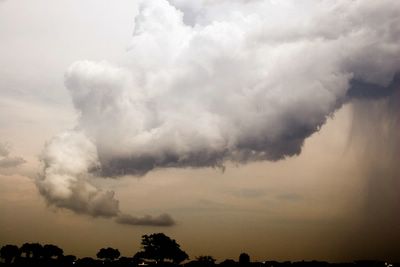 May 29, 2006. Prosper Texas.The 'rain/downpour' is ot the right in this photo. Photographer states :: A storm in north Texas today took on a life of it's own. This cloud extended down from the base of the thunderstorm and was visibly twisting around itself. It was incredible to see.IT'S GOIN' TA BE BAD ! Stuff no one has seen before. The 'heat' in the south already is in the 90s.
 May 29, 2006. 2103z. The Water Vapor Satellite of UNISYS of the North and West Hemisphere. The 'heat' transfer from the 'Gufl' is rather intense. Those would be the big white spots. There had to be some dangerous weather under those. This is an image from twelve hours ago.
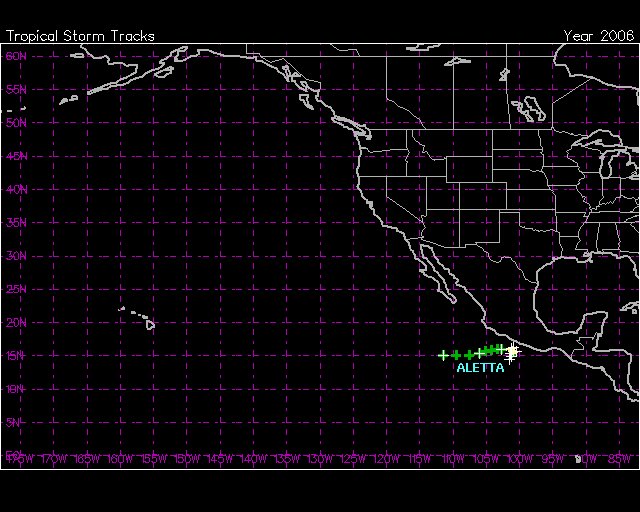
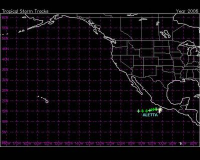 "Heads Up"We are off and running. This is 'exactly' the location of every Pacific storm that accompanied any Atlantic storm, including Katrina, that arrived on terra firma last year. I am not surprised the first manifestations of storms this year starts there.
MEXICO CITY – Tropical Storm Aletta, the first tropical storm of the eastern Pacific season, was stalled Monday about 165 kilometers (102 miles) southwest of Acapulco.
Forecasters issued a tropical storm warning from Punta Maldonado northwestward to the beach resort of Zihuatanejo, warning that the storm could bring heavy rainfall, flash flooding and mudslides to the mountainous coastline.
However, the storm was expected to begin inching farther out to sea.
Maximum sustained winds were at 75 kph (45 mph) and some strengthening was expected, according to a report by the U.S. National Hurricane Center in Miami.