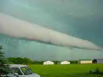
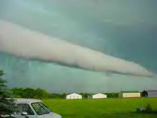
July 6, 2004. This is characterized as a Shelf Roll Cloud. It is a front to a storm system. This is the closest I can find to understand The Tunnel Cloud below. I have noted these clouds at this altitude on the coastal plain of North Carolina. I have also another picture of one that emerges from a cloud bank at approximately this same altitude in Iceland. However, the phenomena below is much higher in altitude and larger in dynamics. The system in this picture occurred before the current Polar Vortices manifested.