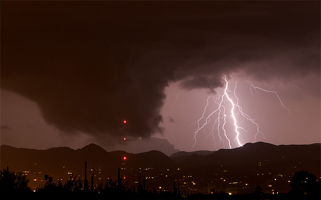
August 8, 2005. Tucson, Arizona. Photographer states :: I sent this picture to a local TV station hoping the weatherman (Chuck George) might know what it was. It made the local news, but all he said was that it was very close to being a funnel cloud. My guess is a wall cloud or a funnel cloud. This was associated with a severe thundershower over Tucson at 1:00 am Monday morning. A loop of the Base Radial Velocity radar over that time showed a distinct 30 MPH to 40 MPH swirl in the winds as the storm passed over south Tucson and moved into the Tucson Mountains, about the same time this picture was taken. The picture was taken from northwest Tucson looking south towards the Tucson Mountains.
