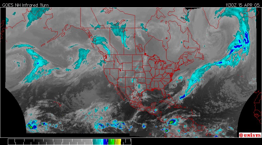
The Enhanced Infrared UNISYS Hemispheric Satellite on April 15, 2005 continues to dictate optimism.Noted: Supercell over The Greenland Ice Sheet streaming down the offshore area of North America to the equator. The western side of the map has lower intensivity heat densities TODAY.
