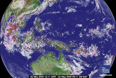
May 22, 2006.
1211 gmt.
Western Pacific Satellite
The oscillating vortex of the South Pacific came to critical mass offshore South America, after the resolution of Typhoon Chanchu.
Energy is constant. Here again there was a large landfall storm that gave the surface ocean relief from absorbing all the 'heat energy/calories' of the troposphere. The reflection of the higher temperatures noted on the Peninsula of Antarctica (which is just south in latitude to the southern tip of South America and is at the highest latitude of the ice continent, remembering these maps are 'flat' and Earth is not) reflects the 'dip' in the equatorial aire masse while some resolution to normal is noted. The land masses often act as a 'conduit' to 'manage' heat movement to the ice continent as well as the Arctic Circle and Arctic Ocean of the northern hemisphere. Land, as noted last week, holds heat far longer than ocean/sea/rivers/ice fields/ice caps.
I would expect the first signs of Global Warming reversal to appear in the Southern Hemisphere where 'heated' land masses are far less in surface area than water surface area.
