November 30, 2005. 1430z.
The Water Vapor Satellite of the North and Western Hemisphere.
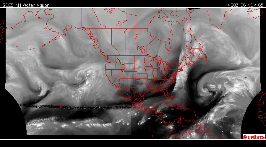
The storm "Epsilon" is in the Mid-Atlantic. The system along the North American east coast has origing at the equator that extends all the way off the satellite image to the left.
There is a vortex west of California and the density of the water vapor of this satellite image is significant.
