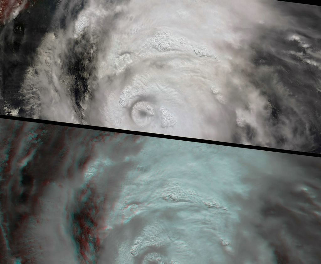
The caption to these images and the one below. This image and animation from NASA�s Multi-angle Imaging SpectroRadiometer (MISR) show the strong convective development of Hurricane Katrina on Saturday, August 27, as it moved west through the Gulf of Mexico. Over 7 minutes during which all 9 MISR cameras viewed Katrina, the animation captures the cloud-top sides, the counterclockwise rotation of the eyewall, and the bubbling growth of the towering cloud structures. At this time, Katrina was undergoing rapid development� it had just been upgraded to a Category 3 hurricane, and within 24 hours it would reach Category 5. On Monday morning when the eyewall made landfall over the United States, it was a Category 4 storm. Hurricane Katrina was one of the most powerful and destructive storms on record for the Atlantic Basin.
