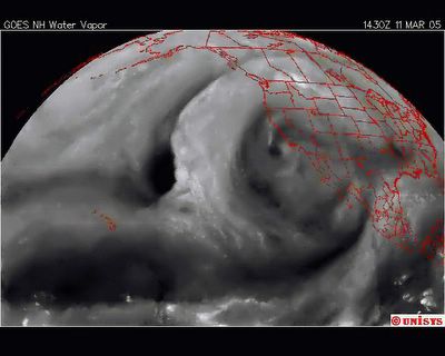
This is the current UNISYS satellite, GOES West 11.3.2005. That is the European notation for date. USA 3.11.2005. The neglect of this issue is an outrage. This is a water vapor satellite and an all new Hemispheric Maximum. It encompasses the entire nation. I put up a regular radar view. You can tell from that. This is Earth grossly imbalanced.