

March 3, 2007
0400 z
GOES Hemispheric satellite compliments of UNISYS.
Thank you, UNISYS.
A few points of reference.
l. In examining this satellite view along with the two below of GOES East and GOES West, there is one thing absent in this view.
Know what it is?
'The curve of the Earth.'
Very important. Very. Okay. Now.
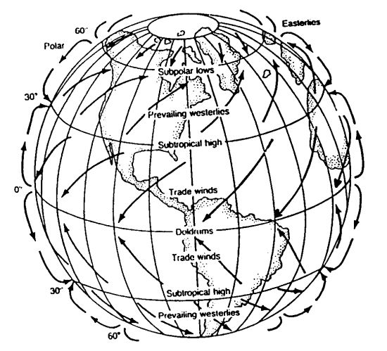
2. The longitude and latitudes of Earth (click on). In particular, considering also 'the curve of the Earth is Latitude 30 North noted in that link. More important than 'just' 30 degrees North are the latitudes 34 to 36 to 38 degrees North. THAT area of the Northern Hemisphere which encircles the globe is a 'boundary area.
The tropospheric boundaries are provided by 'prevailing winds.' (click on) Those prevailing winds are provided my some geophysics of Earth. If Earth did not 'spin' on it's axis it would not have winds. So, to understand greater aspects of Geophysics such as Coriolis is to appreciate the brevity of Earth's winds. No winds, no weather, no rain. You want to talk about a hostile climate? Well, that's another discussion.
Don't know what the Coriolis effect is? Look it up. You're on the net. Be smart. Use the tools available to you. They 'ain't' everything, but, they are a very good start to answer questions that lead to more questions that lead to some library somewhere and more investigation for those that care to.
Okay. Now.
3. Realizing the importance of the curve of Earth and it's contribution to 'buffeting' air into winds and currents is to realize there is a 'lethargy' of Earth's troposphere to change. Benevolence. Earth is the most benevolent planet in the Milky Way Gallaxy. Consistent, based in geophysics. Unchanging in longevity of benevolence.
So, when circumstances of Earth change that very nature of consistent benevolence it MUST BE significant in it's impact. Right? What does it take to change the position of a pen lying on a table to one lying on the floor? Force. A vector force. Those physics are very powerful. They change the very nature of a pen in it's location. In the case of a pen falling to the floor from a table that vector force is gravity. Powerful. It is a benevolent vector force of Earth.
Now.
To discuss the events of March 2, 2007 (click on) in respect to the deaths we need to realize the event was 'nurtured' through 'normally' benevolent/natural forces of Earth altered by high concentrations of carbon dioxide in the troposphere deposited by the USA and it's gluttonous economic indulgences in transportation and energy sectors. Nurtured from the point of view that the USA is emitting the highest concentrations of carbon dioxide of Earth. Not only that but we have witnessed clear 'plans/agendas' to continue these emissions and also increase them. The government of the USA lacks benevolence towards it's citizens and the populous of Earth.
Now. About March 2, 2007.
The air patterns before the sun rose on March 2, 2007 were mostly circulating in vortex over the Arctic Ocean waters with contibuting vortices of the Arctic Oscillation and the North Atlantic Oscillation permanently acting in their roles of Human Induced Global Warming.
Example of the 'sun rise' over the Eastern Pacific.(click on)
The 'equinox' whereby the sunlight of Sol passes over the Equator from the Southern hemisphere of Earth to the northern hemisphere of Earth will occur soon. It's called the beginning of Spring in the Northern hemisphere and the beginning of Autumn in the Southern Hemisphere. In realizing the curve of Earth and the traversing sunlight of Sol is to realize the 'centrally concentrated' rays of Sol passes at angles to Earth on it's axis. If one were to draw a straight line between Sol and the angle of those rays in relation to Earth one would realize the most centrally concentrated rays would be over the East Pacific on sunrise on March 2, 2007.
This now gets a little more 'concentrated' in presistence. In looking at the picture above of the Water Vapor Hemispheric Satellite I want those seeking to understand my point of view to find a 'line' of clouds that run from the left side to the right at about the latitude 36 North. That 'line' would be at the Mason Dixon Line starting in the Eastern USA at the North Carolina northern border and extending across the country.
All those clouds currently below that line 'occur' and are not 'a permanent' aspect of the Arctic Ocean Vortex. It is clear they 'occur' because they extend to the Equator and are rarely there persistently on any one day. All clouds above the 36 North designation are always there in water vapor but not necessarily in 'weather related clouds.'
Upon sunrise, the 'heat' from Sol's rays warmed areas in the Eastern Pacific 'preloaded' with latent heat from vaporizing waters. The added heat pushed the existing 'water vapor heat load' over the top of it's ability to remain 'calm' in it's latitude to a mass of superhot air. Now, superhot does not mean anything close to 'boiling,' it simply means it's the point where 'heat/calories' turns into massive water vapor movement.
With the understanding there was a huge heat driven system spawning in the Eastern Pacific nearer the equator than further from it, was to realize it was going to move. The heat was so strong that if there was a film loop of that event here, I would be able to point to two small and short lived hurricane systems at the very western edge of that system. They dissipated quickly.
Realizing how and where air masses move in the form of wind on Earth; which direction was this massive hot air in the Eastern Pacific going to move?
Right. To the east and north as noted even today in satellite, but, not because of 'prevailing trade winds' but a much different and more powerful 'geophysics' exclusively spawned under thick carbon dioxide layers. A supercell. A vortex so powerful that it can pull the air mass north and east in a velocity unnatural to Earth's benevolent troposphere.
To know the 'supercell/vortex' was anticipated is to realize it would have to spawn. Begin. It would not 'assist' that massive heat displacement immediately. The physics of the circumstances on Earth would have to accommodate the heat displacement and true to form it did.
At the beginning of the vortex formation the 'heat calories' of the Pacific system would not move in the velocity it would later as the 'supercell' took up the movement to the Arctic Circle. Yet. The heat calories would be consistent in their location with movement in a small area.
How does that interpret in 'real weather' events?
If one took a circulating hot air mass and made it into weather systems how many could one have?
Many.
Some are as benevolent as a spring drizzle spawning a rainbow all the way to a tornado with precursor hail. If one ran an experiment on what type of 'weather event' would occur with a 'fixed' amount of water vapor and heat, the ONE delineating factor in the intensity of the event would depend on 'surface area.' Greater surface area the less turbulent the event. So to concentrate a massive heat event at the end of a developing vortex is to realize the 'latent' system would cause intense movement of that air.
As the heat moved across land from sea, the heat increased as it no longer had a cooler ocean to 'buffer' the intensity of the heat. As that occurred the northern supercell was 'amassing' into an all too familiar vorticity that would carry the heat intensity from the Equator to the Arctic Ocean. As the 'drag' on the system continued there was a massive movement into small intense vorticities called tornadoes.
Those tornadoes are what caused the deaths in the Southern USA and Missouri. It would not be any different. This was the way the 'Eastern Pacific System' would find it's intensity until the northern votex now nearing the Great Lakes grew in formation and hence intensity.
As the intensity of the northern vorticity grew there was also an increase in the velocity of the system moving toward the Arctic Circle. Once the velocity of the northern vortex exceeded the 'potential' for tornadoes (the velocity increases the surface area of the heat mass) the system would be more benevolent and less 'tornadic.'
As I stood in open spaces observing the system as it moved across the coastal plain of North Carolina there was a warning that came from "The Federal Emergency Notification/Management System." It dominated the radiowaves. It clearly stated there was a tornado watch for specific areas of the coastal areas of North Carolina. Now, by coastal I refer to the waters offshore as well as 100 miles inland from the coast. These were the areas under 'the watch.'
It was correct to issue it, but, in standing in the middle of this mess I realized the upper tropospheric winds spawned by the ever increasing and competent northern vortex would provide higher velocity to the system that would not allow the 'touch down' of any tornadic events. The 'danger' to human life was over and all that was left was more demise to the ice formations of Earth.
The event exhibited many variables in wind, rain and cloud formations. This due to the ever increasing northern vortex and it's velocity. The air masse was 'taking shape' and in doing so there were areas of intense wind and rain while other areas were left almost stagnant without percipitation.
These are dangerous systems that should never be taken lightly.
I have observed Human Induced Global Warming for many years now. I have YET to see it diminish. Every year. Every season of the year. The intensity increases.
The United States of American needs to aggressively reverse it's economic trends that lead to these events. Leadership such as exists in the Executive Branch today don't 'cut it.' They WANT the warming to 'lay bare' the areas of the Arctic Circle with oil gluts.
We have to stop this. People are dying.