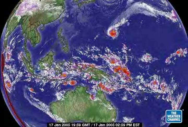
West Pacific Global Satellite 1.17.05

This is primarily the equatorial area of the Eastern Hemisphere. Noted the excess heat but then it is Summer in the Southern Hemisphere. In the top right quarter of this satellite picture is a storm. The big red spot. If one will note it has something in common with the hurricanes of the Atlantic 2004. It is at the end of a vortex peripheral flow off the North Polar Vortex. It is an 'eddy' to the Arctic Ocean Vortex (North Polar Cap - same thing.) Progressing in 'knowing' the next slide shows it's progression across the Pacific to the North American continent.