August 5, 2006.
0630z.
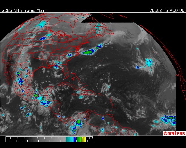
UNISYS Infrared GOES East Satellite.
Kindly compare the satellite below in relation to the amount of storms along the Gulf Coast and the East Coast of the USA. Also note the storms moving through Wilmington, NC. There is also the familiar storm in the Central Northern Midwest.
Now, when Chris entered the picture coming off Africa as Sol's radiant heat moved south toward the equator the 'vortex' over Mexico was not as unstable or as violently dynamic. The storms along the Gulf Coast were few and far between. With the exception of the Florida panhandle there was little to complain about. Even the upper Midwest was not in such bad shape. Most of the turbulence in the troposphere for the USA was all at sea. Also the 'resident' vortex in the Mid-Atlantic was still churning away.
Then, Chris decided; during 'nighttime' hours when no radiant wavelengths from Sol would 'stir the pot' so to speak; to 'calm down' and eventually 'go away' at least to the Hurricane Prediction Center. So where does a storm like that 'get' energy and why does it just 'stop?'
Hm.
I'll finish below with a satellite picture that manifested after a full day of sun, loaded with additional 'heat' calories and no place to put them..
