 Arctic Ice Melting at Alarming Pace as Temperatures Rise (click here)
New studies show that the region is warming even faster than many scientists had feared
By Thomas Omestad
Posted December 16, 2008
New studies being released this week indicate that climate change is exerting massive and worrying change on the Arctic region—reducing the volume of ice, releasing methane gas into the atmosphere, and dramatically raising air temperatures in some parts of the Arctic....
...NASA scientists will reveal that more than 2 trillion tons of land ice on Greenland and Alaska, along with in Antarctica, have melted since 2003. Satellite measurements suggest half of the loss has come from Greenland. Melting of land ice slowly raises sea levels.
The World Meteorological Organization, a United Nations agency, is also reporting that ice volume in the Arctic this year fell to its lowest recorded level to date.
Experts from the National Snow and Ice Data Center in Colorado will further reveal that temperatures this fall in some Arctic areas north of Alaska were 9 or 10 degrees Fahrenheit above average. The long-predicted phenomenon is known as "Arctic amplification." As global air temperatures increase, the Arctic tends to show greater changes because the ice pack that once reflected solar heat is reduced in scope. More heat is therefore absorbed. The study is being discussed at a meeting of the American Geophysical Union in San Francisco....
What has occurred in the recent past in federal employment are layoffs and firings and all that mess, probably depriving people of rightful retirement benefits as well.
See, in this instance people in the extreme Right Wing views spending on PERSONNEL frivilous. They rather average folks, whether employed or not, purchase flood insurance regardless of the danger. The argument can be made that with Climate Change people should purchase flood insurance. It is unpredictable. But, if one is to follow that logic then there is even MORE REASON to employee people to monitor the gauges and report regularly any and all anticpated dangers based on history and 'New Climate Data.'
There is basically NO REASON for these gauges to be unattended and reported on regularly. We could be saving lives, regardless of flood insurance.
Cold front sweeps across Dallas-Fort Worth area on first day of winter (click here)
07:11 PM CST on Sunday, December 21, 2008
WFAA-TV
Today is the first day of winter, and a cold front sweeping across North Texas caused temperatures to fall into the upper 20s and high teens by daybreak, with wind chills dipping into the single digits at some reporting stations.
At 8 a.m., the National Weather Service reported it was 18 degrees in Denton and Decatur; 19 degrees at McKinney, Sherman/Denison and Fort Worth Meacham Airport.
In spite of a lot of sunshine on Sunday, forecast high temperatures will struggle to reach the lower 40s with a brisk north wind. But this is also the winter solstice, day the sun sets soonest (at 5:25 p.m. in Dallas)....

Winter storm idles athletes (click here)
By Tribune Staff
December 14, 2008
A wicked winter storm that hit north central Montana early Saturday morning played havoc with many scheduled prep sporting events....
People need to be checking these river gauges. They could simply be frozen as most of the NOW seven gauges registering 'severe flooding' are in areas of cold percipitation, except in Texas. I need to look at that one. But, at rate, there can be ice jams that might be artifically increasing the reading. Regardless, that is a concern that local and state authorities need to know. The federal government has a lot of people to put back to work and soon. As a matter of fact there might be significant taxes outstanding that need to be collected as well. Hello?

Looks like Amtrack needs to hire a few folks. Huh?
Update: Amtrak train delayed 18 hours; overtime causes crew to wait 3 hours before traveling last 25 miles (click here)
by Ken Kolker The Grand Rapids Press
Monday December 22, 2008, 9:05 AM
 Grand Rapids, Michigan gauge shows flood stage over 12 feet (click here) and the gauge is registering well over that.
 December 22, 2008
1330z
UNISYS Water Vapor GOES West Satellite (click title to entry - thank you)
The vortex southwest of the Baja Peninsula has proven to stabilize an air mass that is now dumping huge amounts of moisture into the central part of the USA. There has been and will continue to be significant snow and some flooding in at least six gauges.


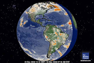
 There is no frigid air over Antartica and a huge heat transfer system is noted from South America arriving over WAIS.
 Vostok, Antarctica (click here)
Local Time: 6:38 PM VOST (GMT +06)
Lat/Lon: 78.4° S 106.9° E Current Conditions Vostok, Antarctica (Airport)
Updated: 36 min 40 sec ago
Temperature :: -9 °F
Conditions :: Clear
Humidity: 42%
Dew Point: -20 °F
Wind: 14 mph from the SSW
Wind Gust: -
Pressure: in (Rising)
Visibility: 12.0 miles
Elevation: 11220 ft
The warmest place the day after the Winter Solstice 2008 is Davis, Antarctica (webcam click here)
Davis, Antarctica
Long/Lat - 68.58S 77.97E
Local Time: 7:45 PM DAVT (GMT +07)
Lat/Lon: 68.6° S 78.0° E
Temperature :: 38 °F
Conditions :: Partly Cloudy
Humidity: 38%
Dew Point: 22 °F
Wind: 13 mph from the North Wind Gust: -
Pressure: 29.31 in (Rising) Visibility: 16.0 miles
Elevation: 59 ft