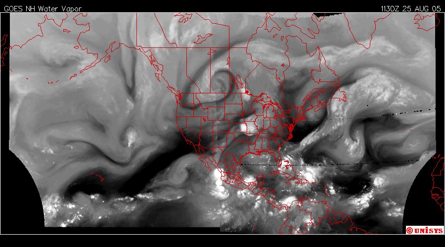
August 25, 2005. The North Polar Vortex is dominating the Climate of North America.
There is a double 'dog leg' that parrellel each coast. The hurricanes on both coasts are the 'eddies' of those peripheral vortex flows. When looking at this image of water vapor one has remember Earth is curved and the 'dog leg' is dictated by land forms and oceans in their shape to some extent. So it might look odd but on a curve it looks more reasonable.
The point is the Pacific Hurricane "Hilary" can come into the Gulf of Mexico potentially.
The tropical storm "Katrina" has stalled and will probably start to move back to the Atlantic. These are tremendously powerful ionic storms that have control over the eddies it manifests. Click on the title to see 12 hour loop.
Looking at the loop it seems like "Katrina" will break away with enough velocity to come inland. Noted also is the substantial storm starting over Kansas. The dynamics are interesting. I don't have computer models to predict anything. Just my hisotry of observation. Listen to the local stations and be safe.
